Reforma geodata
Reforma (Chiapas) is a seat of a second-order administrative division; located in Mexico in America/Mexico_City (GMT-6) time zone. With population of 26,257 people, there are 383 cities with bigger population in this country. Compared to other cities in Mexico, 80% of cities are located further ↑North; 87.8% of cities are located further ←West and 89% of cities have higher elevation than Reforma. Note1


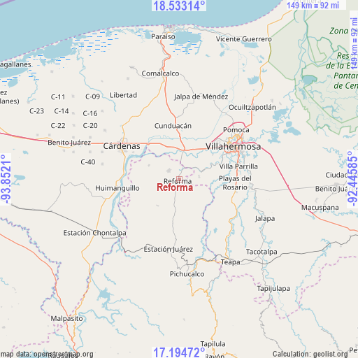
Reforma GPS coordinates[2]
17° 51' 54.684" North, 93° 8' 56.292" West
| Map corner | latitude | longitude |
|---|---|---|
| Upper-left | 18.53314°, | -93.8521° |
| Center: | 17.86519°, | -93.14897° |
| Lower-right: | 17.19472°, | -92.44585° |
| Map W x H: | 148.8×148.8 km | = 92.5×92.5mi |
| max Lat: | 32.7° ⇑80% North |
| Reforma: | 17.86519° |
| min Lat: | ⇓20% South 14.53588° |
| min Long | Reforma | max Long |
| -117.105° | -93.14897° | -86.73105° |
| W 87.8%⇐ | ⇒12.2% E |
Elevation
Elevation of Reforma is 27 m = 89 ft, and this is 1226.7 m = 4025 ft below average elevation for this country.
| Max E: |
3497 m = 11473 ft | 89% |
| Avg. | 1253.7 m = 4113 ft | |
| Reforma | 27 m = 89 ft | |
Min E: |
-1 m = -3 ft | 11% |
See also: Mexico elevation on elevation.city.
Geographical zone
Reforma is located in North Torrid zone (between Equator and Tropic of Cancer). Distance of this Northern Tropic circle is 619.5 km =384.9 mi to North.| Distance of | km | miles | from Reforma |
|---|---|---|---|
| North Pole | 8020.6 | 4983.8 | to North |
| Arctic Circle | 5414.8 | 3364.6 | to North |
| Tropic Cancer | 619.5 | 384.9 | to North |
| Equator | 1986.4 | 1234.3 | to South |


Nearby cities:
15 places around Reforma: (largest is in red/bold)
• Cumuapa 1ra. Sección
13.4 km =8.3 mi,  4°
4°
• El Carmen (El Limón)
3.3 km =2.1 mi,  328°
328°
• El Paraíso
14.2 km =8.8 mi,  217°
217°
• Luis Gil Pérez
8.3 km =5.2 mi,  82°
82°
• Marín
15.1 km =9.4 mi,  343°
343°
• Marín (Rampa de Panuncio)
15 km =9.3 mi, 336°
• Miguel Hidalgo
5.7 km =3.5 mi,  36°
36°
• Nuevo Volcán Chichonal
11.1 km =6.9 mi,  157°
157°
• Pablo L. Sidar
13.3 km =8.3 mi,  72°
72°
• Rafael Pascacio Gamboa
13.9 km =8.6 mi,  295°
295°
• San Eligio
12.6 km =7.8 mi,  15°
15°
• San Miguel 2da. Sección
5.2 km =3.2 mi, 330°
• Santa Cruz
6.5 km =4 mi,  193°
193°
• Santa Cruz Tepate Abajo
13.9 km =8.6 mi,  121°
121°
• Vicente Guerrero
2.6 km =1.6 mi, 23°
Sources, notices
• [Note1] Compared only with cities in Mexico existing in our database
• [Src1] Map data: © OpenStreetMap contributors (CC-BY-SA)
• [Src2] Other city data from geonames.org with taken over terms of usage.
• [Src3] Geographical zone / Annual Mean Temperature by Robert A. Rohde @ Wikipedia
