Nuevo Volcán Chichonal geodata
Nuevo Volcán Chichonal (Chiapas) is a populated place; located in Mexico in America/Mexico_City (GMT-6) time zone. With population of 1,162 people, there are 7463 cities with bigger population in this country. Compared to other cities in Mexico, 80.8% of cities are located further ↑North; 88.1% of cities are located further ←West and 85.1% of cities have higher elevation than Nuevo Volcán Chichonal. Note1
Current local time in Nuevo Volcán Chichonal:
06:36 AM, WednesdayDifference from your time zone: hours


Nuevo Volcán Chichonal GPS coordinates[2]
17° 46' 21.468" North, 93° 6' 34.38" West
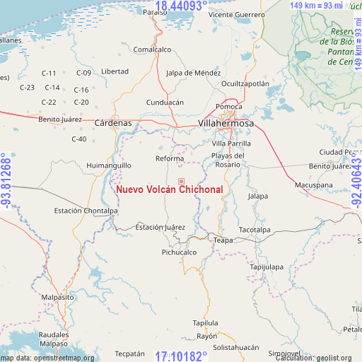
| Map corner | latitude | longitude |
|---|---|---|
| Upper-left | 18.44093°, | -93.81268° |
| Center: | 17.77263°, | -93.10955° |
| Lower-right: | 17.10182°, | -92.40643° |
| Map W x H: | 148.9×148.9 km | = 92.5×92.5mi |
| max Lat: | 32.7° ⇑80.8% North |
| Nuevo Volcán Chichonal: | 17.77263° |
| min Lat: | ⇓19.2% South 14.53588° |
| min Long | Nuevo Volcán C | max Long |
| -117.105° | -93.10955° | -86.73105° |
| W 88.1%⇐ | ⇒11.9% E |
Elevation
Elevation of Nuevo Volcán Chichonal is 43 m = 141 ft, and this is 1210.7 m = 3972 ft below average elevation for this country.
| Max E: |
3497 m = 11473 ft | 85.1% |
| Avg. | 1253.7 m = 4113 ft | |
| Nuevo Volcán Chichonal | 43 m = 141 ft | |
Min E: |
-1 m = -3 ft | 14.9% |
See also: Mexico elevation on elevation.city.
Geographical zone
Nuevo Volcán Chichonal is located in North Torrid zone (between Equator and Tropic of Cancer). Distance of this Northern Tropic circle is 629.8 km =391.3 mi to North.| Distance of | km | miles | from Nuevo Volcán Chichonal |
|---|---|---|---|
| North Pole | 8030.9 | 4990.2 | to North |
| Arctic Circle | 5425 | 3370.9 | to North |
| Tropic Cancer | 629.8 | 391.3 | to North |
| Equator | 1976.1 | 1227.9 | to South |


Nearby cities:
15 places around Nuevo Volcán Chichonal: (largest is in red/bold)
• Andrés Quintana Roo
12.7 km =7.9 mi,  124°
124°
• El Carmen (El Limón)
14.4 km =8.9 mi,  335°
335°
• El Paraíso
12.9 km =8 mi,  265°
265°
• Hermenegildo Galeana
14.5 km =9 mi,  128°
128°
• Huapaque 1ra. Sección (Huapacón)
16 km =9.9 mi,  259°
259°
• Luis Gil Pérez
12.1 km =7.5 mi,  19°
19°
• Miguel Hidalgo
14.9 km =9.3 mi,  356°
356°
• Nuevo Nicapa
15.8 km =9.8 mi,  165°
165°
• Pablo L. Sidar
16.5 km =10.3 mi,  30°
30°
• Pueblo Juárez
15.3 km =9.5 mi,  200°
200°
• Reforma
11.1 km =6.9 mi, 337°
• San Miguel 2da. Sección
16.3 km =10.1 mi, 335°
• Santa Cruz
6.9 km =4.3 mi,  305°
305°
• Santa Cruz Tepate Abajo
8.3 km =5.2 mi,  68°
68°
• Vicente Guerrero
13 km =8.1 mi,  346°
346°
Sources, notices
• [Note1] Compared only with cities in Mexico existing in our database
• [Src1] Map data: © OpenStreetMap contributors (CC-BY-SA)
• [Src2] Other city data from geonames.org with taken over terms of usage.
• [Src3] Geographical zone / Annual Mean Temperature by Robert A. Rohde @ Wikipedia
