Quiamoloapan geodata
Quiamoloapan (Veracruz) is a populated place; located in Mexico in America/Mexico_City (GMT-6) time zone. With population of 1,564 people, there are 5523 cities with bigger population in this country. Compared to other cities in Mexico, 78% of cities are located further ↑North; 84.6% of cities are located further ←West and 76.4% of cities have higher elevation than Quiamoloapan. Note1


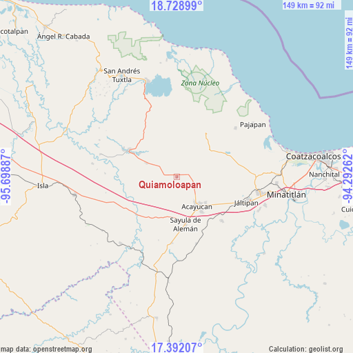
Quiamoloapan GPS coordinates[2]
18° 3' 42.48" North, 94° 59' 44.664" West
| Map corner | latitude | longitude |
|---|---|---|
| Upper-left | 18.72899°, | -95.69887° |
| Center: | 18.0618°, | -94.99574° |
| Lower-right: | 17.39207°, | -94.29262° |
| Map W x H: | 148.7×148.7 km | = 92.4×92.4mi |
| max Lat: | 32.7° ⇑78% North |
| Quiamoloapan: | 18.0618° |
| min Lat: | ⇓22% South 14.53588° |
| min Long | Quiamoloapan | max Long |
| -117.105° | -94.99574° | -86.73105° |
| W 84.6%⇐ | ⇒15.4% E |
Elevation
Elevation of Quiamoloapan is 173 m = 568 ft, and this is 1080.7 m = 3546 ft below average elevation for this country.
| Max E: |
3497 m = 11473 ft | 76.4% |
| Avg. | 1253.7 m = 4113 ft | |
| Quiamoloapan | 173 m = 568 ft | |
Min E: |
-1 m = -3 ft | 23.6% |
See also: Mexico elevation on elevation.city.
Geographical zone
Quiamoloapan is located in North Torrid zone (between Equator and Tropic of Cancer). Distance of this Northern Tropic circle is 597.6 km =371.3 mi to North.| Distance of | km | miles | from Quiamoloapan |
|---|---|---|---|
| North Pole | 7998.8 | 4970.2 | to North |
| Arctic Circle | 5392.9 | 3351 | to North |
| Tropic Cancer | 597.6 | 371.3 | to North |
| Equator | 2008.3 | 1247.9 | to South |


Nearby cities:
15 places around Quiamoloapan: (largest is in red/bold)
• Campo de Águila
1.2 km =0.7 mi,  58°
58°
• Cirilo Vázquez Lagunes
11.7 km =7.3 mi,  135°
135°
• Colonia Hermosa
9 km =5.6 mi,  321°
321°
• Comején
11.7 km =7.3 mi,  90°
90°
• Cuilonia Nuevo
13.4 km =8.3 mi,  39°
39°
• Dehesa
13.4 km =8.3 mi,  181°
181°
• El Hato
8.1 km =5 mi,  153°
153°
• Esperanza Malota
7.6 km =4.7 mi,  228°
228°
• Ixtagapa
6 km =3.7 mi,  96°
96°
• La Estribera
12.9 km =8 mi, 61°
• Monte Grande
11 km =6.8 mi, 97°
• Nacaxtle
12.3 km =7.6 mi,  328°
328°
• Pitalillo
8.6 km =5.3 mi,  73°
73°
• San Miguel
4.5 km =2.8 mi,  76°
76°
• Tecuanapa
10.8 km =6.7 mi,  126°
126°
Sources, notices
• [Note1] Compared only with cities in Mexico existing in our database
• [Src1] Map data: © OpenStreetMap contributors (CC-BY-SA)
• [Src2] Other city data from geonames.org with taken over terms of usage.
• [Src3] Geographical zone / Annual Mean Temperature by Robert A. Rohde @ Wikipedia
