La Estribera geodata
La Estribera (Veracruz) is a populated place; located in Mexico in America/Mexico_City (GMT-6) time zone. With population of 737 people, there are 11858 cities with bigger population in this country. Compared to other cities in Mexico, 77.3% of cities are located further ↑North; 84.9% of cities are located further ←West and 77.4% of cities have higher elevation than La Estribera. Note1


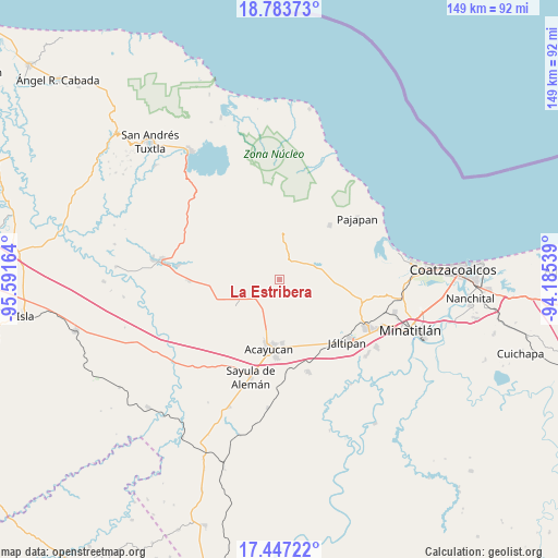
La Estribera GPS coordinates[2]
18° 7' 0.3" North, 94° 53' 18.636" West
| Map corner | latitude | longitude |
|---|---|---|
| Upper-left | 18.78373°, | -95.59164° |
| Center: | 18.11675°, | -94.88851° |
| Lower-right: | 17.44722°, | -94.18539° |
| Map W x H: | 148.6×148.6 km | = 92.3×92.3mi |
| max Lat: | 32.7° ⇑77.3% North |
| La Estribera: | 18.11675° |
| min Lat: | ⇓22.7% South 14.53588° |
| min Long | La Estribera | max Long |
| -117.105° | -94.88851° | -86.73105° |
| W 84.9%⇐ | ⇒15.1% E |
Elevation
Elevation of La Estribera is 143 m = 469 ft, and this is 1110.7 m = 3644 ft below average elevation for this country.
| Max E: |
3497 m = 11473 ft | 77.4% |
| Avg. | 1253.7 m = 4113 ft | |
| La Estribera | 143 m = 469 ft | |
Min E: |
-1 m = -3 ft | 22.6% |
See also: Mexico elevation on elevation.city.
Geographical zone
La Estribera is located in North Torrid zone (between Equator and Tropic of Cancer). Distance of this Northern Tropic circle is 591.5 km =367.5 mi to North.| Distance of | km | miles | from La Estribera |
|---|---|---|---|
| North Pole | 7992.7 | 4966.4 | to North |
| Arctic Circle | 5386.8 | 3347.2 | to North |
| Tropic Cancer | 591.5 | 367.5 | to North |
| Equator | 2014.4 | 1251.7 | to South |


Nearby cities:
15 places around La Estribera: (largest is in red/bold)
• Amamaloya
9.2 km =5.7 mi,  67°
67°
• Cerro de la Palma
7.7 km =4.8 mi,  46°
46°
• Comején
6.2 km =3.9 mi,  177°
177°
• Cuilonia Nuevo
5 km =3.1 mi,  327°
327°
• Huazuntlán
11 km =6.8 mi, 66°
• Ixhuapán
11.5 km =7.1 mi,  55°
55°
• Ixtagapa
8.7 km =5.4 mi,  218°
218°
• Las Palomas (Bajo Paloma)
3.6 km =2.2 mi,  338°
338°
• Monte Grande
7.5 km =4.7 mi, 182°
• Morelos
9.5 km =5.9 mi,  317°
317°
• Pitalillo
4.8 km =3 mi, 220°
• Saltillo
6 km =3.7 mi,  38°
38°
• San Andrés Chamilpa
4.6 km =2.9 mi,  127°
127°
• San Miguel
8.6 km =5.3 mi,  234°
234°
• Tonalapa
10.7 km =6.6 mi, 70°
Sources, notices
• [Note1] Compared only with cities in Mexico existing in our database
• [Src1] Map data: © OpenStreetMap contributors (CC-BY-SA)
• [Src2] Other city data from geonames.org with taken over terms of usage.
• [Src3] Geographical zone / Annual Mean Temperature by Robert A. Rohde @ Wikipedia
