Nacaxtle geodata
Nacaxtle (Veracruz) is a populated place; located in Mexico in America/Mexico_City (GMT-6) time zone. With population of 842 people, there are 10390 cities with bigger population in this country. Compared to other cities in Mexico, 76.8% of cities are located further ↑North; 84.4% of cities are located further ←West and 80.4% of cities have higher elevation than Nacaxtle. Note1


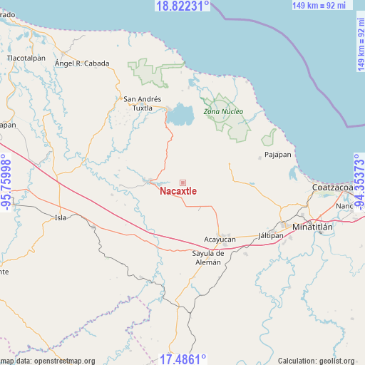
Nacaxtle GPS coordinates[2]
18° 9' 19.728" North, 95° 3' 24.66" West
| Map corner | latitude | longitude |
|---|---|---|
| Upper-left | 18.82231°, | -95.75998° |
| Center: | 18.15548°, | -95.05685° |
| Lower-right: | 17.4861°, | -94.35373° |
| Map W x H: | 148.6×148.6 km | = 92.3×92.3mi |
| max Lat: | 32.7° ⇑76.8% North |
| Nacaxtle: | 18.15548° |
| min Lat: | ⇓23.2% South 14.53588° |
| min Long | Nacaxtle | max Long |
| -117.105° | -95.05685° | -86.73105° |
| W 84.4%⇐ | ⇒15.6% E |
Elevation
Elevation of Nacaxtle is 89 m = 292 ft, and this is 1164.7 m = 3821 ft below average elevation for this country.
| Max E: |
3497 m = 11473 ft | 80.4% |
| Avg. | 1253.7 m = 4113 ft | |
| Nacaxtle | 89 m = 292 ft | |
Min E: |
-1 m = -3 ft | 19.6% |
See also: Mexico elevation on elevation.city.
Geographical zone
Nacaxtle is located in North Torrid zone (between Equator and Tropic of Cancer). Distance of this Northern Tropic circle is 587.2 km =364.9 mi to North.| Distance of | km | miles | from Nacaxtle |
|---|---|---|---|
| North Pole | 7988.4 | 4963.8 | to North |
| Arctic Circle | 5382.5 | 3344.5 | to North |
| Tropic Cancer | 587.2 | 364.9 | to North |
| Equator | 2018.7 | 1254.4 | to South |


Nearby cities:
15 places around Nacaxtle: (largest is in red/bold)
• Campo de Águila
12.3 km =7.6 mi,  142°
142°
• Colonia Hermosa
3.4 km =2.1 mi,  165°
165°
• Corral Nuevo
7.7 km =4.8 mi,  233°
233°
• El Aguacate
10.3 km =6.4 mi,  62°
62°
• Hueyapan de Ocampo
9.8 km =6.1 mi,  263°
263°
• Loma de Sogotegoyo
11.3 km =7 mi,  51°
51°
• Loma de la Palma
12.3 km =7.6 mi,  36°
36°
• Loma de los Ingleses
12.6 km =7.8 mi, 262°
• Los Mangos
12 km =7.5 mi,  324°
324°
• Morelos
11.6 km =7.2 mi,  76°
76°
• Quiamoloapan
12.3 km =7.6 mi,  148°
148°
• Sabaneta
7.9 km =4.9 mi,  341°
341°
• San Ángel
8.3 km =5.2 mi,  237°
237°
• Santa Rosa Loma Larga
9 km =5.6 mi, 339°
• Tierra Nueva
6.9 km =4.3 mi,  32°
32°
Sources, notices
• [Note1] Compared only with cities in Mexico existing in our database
• [Src1] Map data: © OpenStreetMap contributors (CC-BY-SA)
• [Src2] Other city data from geonames.org with taken over terms of usage.
• [Src3] Geographical zone / Annual Mean Temperature by Robert A. Rohde @ Wikipedia
