Progreso de Alvaro Obregon geodata
Progreso de Alvaro Obregon (Hidalgo) is a populated place; located in Mexico in America/Mexico_City (GMT-6) time zone. With population of 17,486 people, there are 554 cities with bigger population in this country. Compared to other cities in Mexico, 62.5% of cities are located further ↓South; 52.6% of cities are located further →East and 73.3% of cities have lower elevation than Progreso de Alvaro Obregon. Note1
Current local time in Progreso de Alvaro Obregon:
10:24 AM, TuesdayDifference from your time zone: hours


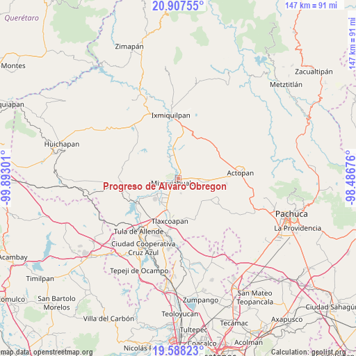
Progreso de Alvaro Obregon GPS coordinates[2]
20° 14' 57.444" North, 99° 11' 23.568" West
| Map corner | latitude | longitude |
|---|---|---|
| Upper-left | 20.90755°, | -99.89301° |
| Center: | 20.24929°, | -99.18988° |
| Lower-right: | 19.58823°, | -98.48676° |
| Map W x H: | 146.7×146.7 km | = 91.2×91.2mi |
| max Lat: | 32.7° ⇑37.5% North |
| Progreso de Alvaro Obregon: | 20.24929° |
| min Lat: | ⇓62.5% South 14.53588° |
| min Long | Progreso de Alv | max Long |
| -117.105° | -99.18988° | -86.73105° |
| W 47.4%⇐ | ⇒52.6% E |
Elevation
Elevation of Progreso de Alvaro Obregon is 1998 m = 6555 ft, and this is 744.3 m = 2442 ft above average elevation for this country.
| Max E: |
3497 m = 11473 ft | 26.7% |
| Progreso de Alvaro Obregon | 1998 m 6555 ft | |
| Avg. | 1253.7 m = 4113 ft | |
Min E: |
-1 m = -3 ft | 73.3% |
See also: Mexico elevation on elevation.city.
Geographical zone
Progreso de Alvaro Obregon is located in North Torrid zone (between Equator and Tropic of Cancer). Distance of this Northern Tropic circle is 354.4 km =220.2 mi to North.| Distance of | km | miles | from Progreso de Alvaro Obregon |
|---|---|---|---|
| North Pole | 7755.6 | 4819.1 | to North |
| Arctic Circle | 5149.7 | 3199.9 | to North |
| Tropic Cancer | 354.4 | 220.2 | to North |
| Equator | 2251.5 | 1399 | to South |


Nearby cities:
15 places around Progreso de Alvaro Obregon: (largest is in red/bold)
• Arbol Grande
4.2 km =2.6 mi,  156°
156°
• Colonia Benito Juárez
7.4 km =4.6 mi,  43°
43°
• Colonia Morelos (El Nueve)
5.8 km =3.6 mi,  117°
117°
• Colonia Teñhe
6.4 km =4 mi,  169°
169°
• Dengantzha
7.6 km =4.7 mi,  70°
70°
• El Moreno (San Miguel Moreno)
6 km =3.7 mi,  16°
16°
• Jagüey Blanco
5 km =3.1 mi,  52°
52°
• La Puerta
7.6 km =4.7 mi,  87°
87°
• Mixquiahuala de Juarez
3.3 km =2.1 mi,  229°
229°
• Motovatha
7.5 km =4.7 mi,  192°
192°
• Palmillas
3.5 km =2.2 mi, 194°
• Santa María Batha
7 km =4.3 mi,  246°
246°
• Texcatepec
7.3 km =4.5 mi,  294°
294°
• Tunititlán
5.7 km =3.5 mi,  270°
270°
• Xochitlán
5.2 km =3.2 mi,  2°
2°
Sources, notices
• [Note1] Compared only with cities in Mexico existing in our database
• [Src1] Map data: © OpenStreetMap contributors (CC-BY-SA)
• [Src2] Other city data from geonames.org with taken over terms of usage.
• [Src3] Geographical zone / Annual Mean Temperature by Robert A. Rohde @ Wikipedia
