Texcatepec geodata
Texcatepec (Hidalgo) is a populated place; located in Mexico in America/Mexico_City (GMT-6) time zone. With population of 1,711 people, there are 5078 cities with bigger population in this country. Compared to other cities in Mexico, 63.1% of cities are located further ↓South; 53.7% of cities are located further →East and 74.5% of cities have lower elevation than Texcatepec. Note1


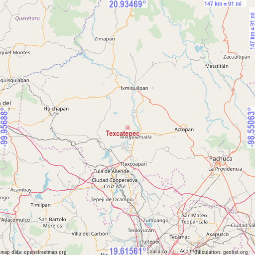
Texcatepec GPS coordinates[2]
20° 16' 35.58" North, 99° 15' 13.5" West
| Map corner | latitude | longitude |
|---|---|---|
| Upper-left | 20.93469°, | -99.95688° |
| Center: | 20.27655°, | -99.25375° |
| Lower-right: | 19.61561°, | -98.55063° |
| Map W x H: | 146.7×146.7 km | = 91.2×91.2mi |
| max Lat: | 32.7° ⇑36.9% North |
| Texcatepec: | 20.27655° |
| min Lat: | ⇓63.1% South 14.53588° |
| min Long | Texcatepec | max Long |
| -117.105° | -99.25375° | -86.73105° |
| W 46.3%⇐ | ⇒53.7% E |
Elevation
Elevation of Texcatepec is 2022 m = 6634 ft, and this is 768.3 m = 2521 ft above average elevation for this country.
| Max E: |
3497 m = 11473 ft | 25.5% |
| Texcatepec | 2022 m 6634 ft | |
| Avg. | 1253.7 m = 4113 ft | |
Min E: |
-1 m = -3 ft | 74.5% |
See also: Mexico elevation on elevation.city.
Geographical zone
Texcatepec is located in North Torrid zone (between Equator and Tropic of Cancer). Distance of this Northern Tropic circle is 351.4 km =218.3 mi to North.| Distance of | km | miles | from Texcatepec |
|---|---|---|---|
| North Pole | 7752.5 | 4817.2 | to North |
| Arctic Circle | 5146.6 | 3197.9 | to North |
| Tropic Cancer | 351.4 | 218.3 | to North |
| Equator | 2254.5 | 1400.9 | to South |


Nearby cities:
15 places around Texcatepec: (largest is in red/bold)
• Chilcuautla
6.5 km =4 mi,  21°
21°
• Colonia Huitexcalco
2.8 km =1.7 mi,  240°
240°
• El Dontzhí (Colonia Álamos)
7.1 km =4.4 mi,  14°
14°
• El Moreno (San Miguel Moreno)
8.8 km =5.5 mi,  71°
71°
• La Palma
6.7 km =4.2 mi,  181°
181°
• Mixquiahuala de Juarez
6.6 km =4.1 mi,  141°
141°
• Palmillas
8.7 km =5.4 mi, 138°
• Panuaya
9.2 km =5.7 mi,  191°
191°
• Progreso de Alvaro Obregon
7.3 km =4.5 mi,  114°
114°
• Santa María Batha
5.8 km =3.6 mi, 177°
• Tenango
6.7 km =4.2 mi,  215°
215°
• Tepeitic
5.5 km =3.4 mi, 224°
• Tezontepec de Aldama
9.8 km =6.1 mi, 192°
• Tunititlán
3.2 km =2 mi,  161°
161°
• Xochitlán
7.2 km =4.5 mi, 72°
Sources, notices
• [Note1] Compared only with cities in Mexico existing in our database
• [Src1] Map data: © OpenStreetMap contributors (CC-BY-SA)
• [Src2] Other city data from geonames.org with taken over terms of usage.
• [Src3] Geographical zone / Annual Mean Temperature by Robert A. Rohde @ Wikipedia
