Cuauzapotitán geodata
Cuauzapotitán (Veracruz) is a populated place; located in Mexico in America/Mexico_City (GMT-6) time zone. With population of 526 people, there are 16064 cities with bigger population in this country. Compared to other cities in Mexico, 55.1% of cities are located further ↓South; 72.7% of cities are located further ←West and 68.1% of cities have higher elevation than Cuauzapotitán. Note1


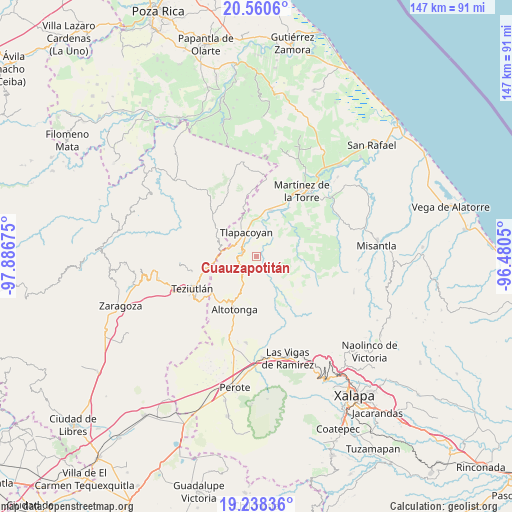
Cuauzapotitán GPS coordinates[2]
19° 54' 3.096" North, 97° 11' 1.032" West
| Map corner | latitude | longitude |
|---|---|---|
| Upper-left | 20.5606°, | -97.88675° |
| Center: | 19.90086°, | -97.18362° |
| Lower-right: | 19.23836°, | -96.4805° |
| Map W x H: | 147×147 km | = 91.3×91.3mi |
| max Lat: | 32.7° ⇑44.9% North |
| Cuauzapotitán: | 19.90086° |
| min Lat: | ⇓55.1% South 14.53588° |
| min Long | Cuauzapotitán | max Long |
| -117.105° | -97.18362° | -86.73105° |
| W 72.7%⇐ | ⇒27.3% E |
Elevation
Elevation of Cuauzapotitán is 526 m = 1726 ft, and this is 727.7 m = 2387 ft below average elevation for this country.
| Max E: |
3497 m = 11473 ft | 68.1% |
| Avg. | 1253.7 m = 4113 ft | |
| Cuauzapotitán | 526 m = 1726 ft | |
Min E: |
-1 m = -3 ft | 31.9% |
See also: Mexico elevation on elevation.city.
Geographical zone
Cuauzapotitán is located in North Torrid zone (between Equator and Tropic of Cancer). Distance of this Northern Tropic circle is 393.2 km =244.3 mi to North.| Distance of | km | miles | from Cuauzapotitán |
|---|---|---|---|
| North Pole | 7794.3 | 4843.2 | to North |
| Arctic Circle | 5188.4 | 3223.9 | to North |
| Tropic Cancer | 393.2 | 244.3 | to North |
| Equator | 2212.8 | 1375 | to South |


Nearby cities:
15 places around Cuauzapotitán: (largest is in red/bold)
• Ahuateno
4.8 km =3 mi,  83°
83°
• Congregación Hidalgo
9.8 km =6.1 mi,  313°
313°
• El Arco
6.9 km =4.3 mi,  301°
301°
• El Campamento
5.7 km =3.5 mi,  15°
15°
• Epapa
10 km =6.2 mi,  274°
274°
• Eytepéquez
6.9 km =4.3 mi, 308°
• Napoala
4.1 km =2.5 mi,  276°
276°
• Nicolás Bravo
7.8 km =4.8 mi,  259°
259°
• Plan de Arroyos
7.9 km =4.9 mi,  96°
96°
• San Isidro
8.3 km =5.2 mi,  328°
328°
• Santa Cruz
5.5 km =3.4 mi,  317°
317°
• Santiago
3.6 km =2.2 mi,  59°
59°
• Tlapacoyan
7.5 km =4.7 mi,  337°
337°
• Vicente Guerrero
9 km =5.6 mi, 282°
• Zapotitlán
8.7 km =5.4 mi,  156°
156°
Sources, notices
• [Note1] Compared only with cities in Mexico existing in our database
• [Src1] Map data: © OpenStreetMap contributors (CC-BY-SA)
• [Src2] Other city data from geonames.org with taken over terms of usage.
• [Src3] Geographical zone / Annual Mean Temperature by Robert A. Rohde @ Wikipedia
