Ojo de Agua geodata
Ojo de Agua (Tabasco) is a populated place; located in Mexico in America/Mexico_City (GMT-6) time zone. With population of 659 people, there are 13168 cities with bigger population in this country. Compared to other cities in Mexico, 79.9% of cities are located further ↑North; 96.7% of cities are located further ←West and 83.9% of cities have higher elevation than Ojo de Agua. Note1


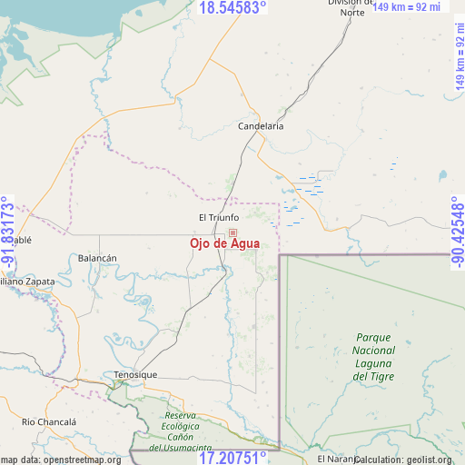
Ojo de Agua GPS coordinates[2]
17° 52' 40.548" North, 91° 7' 42.96" West
| Map corner | latitude | longitude |
|---|---|---|
| Upper-left | 18.54583°, | -91.83173° |
| Center: | 17.87793°, | -91.1286° |
| Lower-right: | 17.20751°, | -90.42548° |
| Map W x H: | 148.8×148.8 km | = 92.5×92.5mi |
| max Lat: | 32.7° ⇑79.9% North |
| Ojo de Agua: | 17.87793° |
| min Lat: | ⇓20.1% South 14.53588° |
| min Long | Ojo de Agua | max Long |
| -117.105° | -91.1286° | -86.73105° |
| W 96.7%⇐ | ⇒3.3% E |
Elevation
Elevation of Ojo de Agua is 52 m = 171 ft, and this is 1201.7 m = 3943 ft below average elevation for this country.
| Max E: |
3497 m = 11473 ft | 83.9% |
| Avg. | 1253.7 m = 4113 ft | |
| Ojo de Agua | 52 m = 171 ft | |
Min E: |
-1 m = -3 ft | 16.1% |
See also: Mexico elevation on elevation.city.
Geographical zone
Ojo de Agua is located in North Torrid zone (between Equator and Tropic of Cancer). Distance of this Northern Tropic circle is 618.1 km =384.1 mi to North.| Distance of | km | miles | from Ojo de Agua |
|---|---|---|---|
| North Pole | 8019.2 | 4982.9 | to North |
| Arctic Circle | 5413.3 | 3363.7 | to North |
| Tropic Cancer | 618.1 | 384.1 | to North |
| Equator | 1987.8 | 1235.2 | to South |


Nearby cities:
15 places around Ojo de Agua: (largest is in red/bold)
• Capitán Felipe Castellanos Díaz (San Pedro)
11.8 km =7.3 mi,  189°
189°
• Cuauhtémoc
9.3 km =5.8 mi,  122°
122°
• El Capulín
19.5 km =12.1 mi,  167°
167°
• El Mical
8.8 km =5.5 mi,  125°
125°
• El Naranjito
5.1 km =3.2 mi,  202°
202°
• El Naranjo
16 km =9.9 mi,  0°
0°
• El Pichi
12.4 km =7.7 mi,  69°
69°
• El Triunfo
6.6 km =4.1 mi,  318°
318°
• El Águila
28.7 km =17.8 mi,  210°
210°
• Ingeniero Emilio López Zamora
9.1 km =5.7 mi, 127°
• La Hulería
30.3 km =18.8 mi,  295°
295°
• Los Cenotes
28.7 km =17.8 mi,  160°
160°
• Miguel Hidalgo y Costilla
29.9 km =18.6 mi,  87°
87°
• Missicab (La Pita)
27 km =16.8 mi,  259°
259°
• Quetzalcóatl (Cuatro Poblados)
9.4 km =5.8 mi, 125°
Sources, notices
• [Note1] Compared only with cities in Mexico existing in our database
• [Src1] Map data: © OpenStreetMap contributors (CC-BY-SA)
• [Src2] Other city data from geonames.org with taken over terms of usage.
• [Src3] Geographical zone / Annual Mean Temperature by Robert A. Rohde @ Wikipedia
