El Águila geodata
El Águila (Tabasco) is a populated place; located in Mexico in America/Mexico_City (GMT-6) time zone. With population of 757 people, there are 11569 cities with bigger population in this country. Compared to other cities in Mexico, 81.7% of cities are located further ↑North; 96.6% of cities are located further ←West and 84.1% of cities have higher elevation than El Águila. Note1


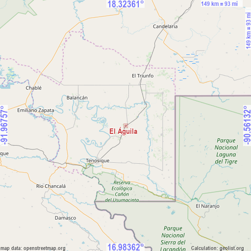
El Águila GPS coordinates[2]
17° 39' 17.496" North, 91° 15' 51.984" West
| Map corner | latitude | longitude |
|---|---|---|
| Upper-left | 18.32361°, | -91.96757° |
| Center: | 17.65486°, | -91.26444° |
| Lower-right: | 16.98362°, | -90.56132° |
| Map W x H: | 149×149 km | = 92.6×92.6mi |
| max Lat: | 32.7° ⇑81.7% North |
| El Águila: | 17.65486° |
| min Lat: | ⇓18.3% South 14.53588° |
| min Long | El Águila | max Long |
| -117.105° | -91.26444° | -86.73105° |
| W 96.6%⇐ | ⇒3.4% E |
Elevation
Elevation of El Águila is 51 m = 167 ft, and this is 1202.7 m = 3946 ft below average elevation for this country.
| Max E: |
3497 m = 11473 ft | 84.1% |
| Avg. | 1253.7 m = 4113 ft | |
| El Águila | 51 m = 167 ft | |
Min E: |
-1 m = -3 ft | 15.9% |
See also: Mexico elevation on elevation.city.
Geographical zone
El Águila is located in North Torrid zone (between Equator and Tropic of Cancer). Distance of this Northern Tropic circle is 642.9 km =399.5 mi to North.| Distance of | km | miles | from El Águila |
|---|---|---|---|
| North Pole | 8044 | 4998.3 | to North |
| Arctic Circle | 5438.1 | 3379.1 | to North |
| Tropic Cancer | 642.9 | 399.5 | to North |
| Equator | 1963 | 1219.8 | to South |


Nearby cities:
15 places around El Águila: (largest is in red/bold)
• Apatzingán
21.6 km =13.4 mi,  103°
103°
• Capitán Felipe Castellanos Díaz (San Pedro)
18.1 km =11.2 mi,  43°
43°
• Certeza
24.3 km =15.1 mi,  207°
207°
• El Capulín
19.6 km =12.2 mi,  72°
72°
• El Naranjito
23.6 km =14.7 mi,  31°
31°
• Estapilla
19.3 km =12 mi,  230°
230°
• Jolochero
24.6 km =15.3 mi,  126°
126°
• Los Cenotes
24.1 km =15 mi, 95°
• Mactún
7.8 km =4.8 mi,  202°
202°
• Missicab (La Pita)
23.2 km =14.4 mi,  328°
328°
• Multé
12.7 km =7.9 mi,  287°
287°
• Netzahualcóyotl
19.9 km =12.4 mi, 288°
• Paraíso (El Tinto)
14.9 km =9.3 mi,  120°
120°
• San Carlos
16.3 km =10.1 mi, 134°
• Tenosique
26.3 km =16.3 mi,  219°
219°
Sources, notices
• [Note1] Compared only with cities in Mexico existing in our database
• [Src1] Map data: © OpenStreetMap contributors (CC-BY-SA)
• [Src2] Other city data from geonames.org with taken over terms of usage.
• [Src3] Geographical zone / Annual Mean Temperature by Robert A. Rohde @ Wikipedia
