Quetzalcóatl (Cuatro Poblados) geodata
Quetzalcóatl (Cuatro Poblados) (Tabasco) is a populated place; located in Mexico in America/Mexico_City (GMT-6) time zone. With population of 677 people, there are 12831 cities with bigger population in this country. Compared to other cities in Mexico, 80.3% of cities are located further ↑North; 96.8% of cities are located further ←West and 86.3% of cities have higher elevation than Quetzalcóatl (Cuatro Poblados). Note1
Current local time in Quetzalcóatl (Cuatro Poblados):
05:31 AM, WednesdayDifference from your time zone: hours


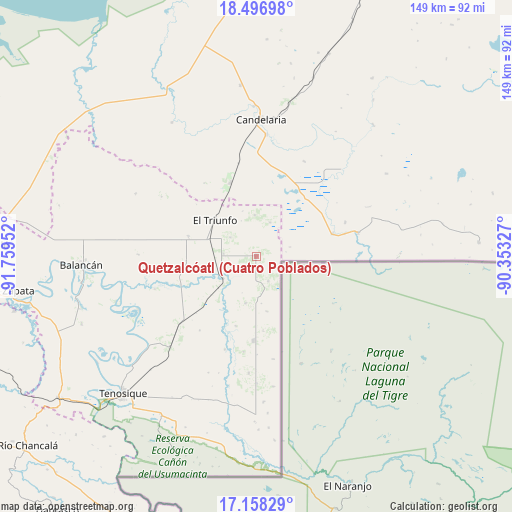
Quetzalcóatl (Cuatro Poblados) GPS coordinates[2]
17° 49' 44.004" North, 91° 3' 23.004" West
| Map corner | latitude | longitude |
|---|---|---|
| Upper-left | 18.49698°, | -91.75952° |
| Center: | 17.82889°, | -91.05639° |
| Lower-right: | 17.15829°, | -90.35327° |
| Map W x H: | 148.8×148.9 km | = 92.5×92.5mi |
| max Lat: | 32.7° ⇑80.3% North |
| Quetzalcóatl (Cuatro Poblados): | 17.82889° |
| min Lat: | ⇓19.7% South 14.53588° |
| min Long | Quetzalcóatl ( | max Long |
| -117.105° | -91.05639° | -86.73105° |
| W 96.8%⇐ | ⇒3.2% E |
Elevation
Elevation of Quetzalcóatl (Cuatro Poblados) is 37 m = 121 ft, and this is 1216.7 m = 3992 ft below average elevation for this country.
| Max E: |
3497 m = 11473 ft | 86.3% |
| Avg. | 1253.7 m = 4113 ft | |
| Quetzalcóatl (Cuatro Poblados) | 37 m = 121 ft | |
Min E: |
-1 m = -3 ft | 13.7% |
See also: Mexico elevation on elevation.city.
Geographical zone
Quetzalcóatl (Cuatro Poblados) is located in North Torrid zone (between Equator and Tropic of Cancer). Distance of this Northern Tropic circle is 623.5 km =387.4 mi to North.| Distance of | km | miles | from Quetzalcóatl (Cuatro Poblados) |
|---|---|---|---|
| North Pole | 8024.7 | 4986.3 | to North |
| Arctic Circle | 5418.8 | 3367.1 | to North |
| Tropic Cancer | 623.5 | 387.4 | to North |
| Equator | 1982.4 | 1231.8 | to South |


Nearby cities:
15 places around Quetzalcóatl (Cuatro Poblados): (largest is in red/bold)
• Apatzingán
24.6 km =15.3 mi,  182°
182°
• Capitán Felipe Castellanos Díaz (San Pedro)
11.5 km =7.1 mi,  237°
237°
• Cuauhtémoc
0.5 km =0.3 mi,  17°
17°
• El Capulín
14 km =8.7 mi,  193°
193°
• El Mical
0.6 km =0.4 mi,  307°
307°
• El Naranjito
9.6 km =6 mi,  274°
274°
• El Naranjo
22.7 km =14.1 mi,  340°
340°
• El Pichi
10.6 km =6.6 mi, 22°
• El Triunfo
15.9 km =9.9 mi, 310°
• Ingeniero Emilio López Zamora
0.5 km =0.3 mi,  257°
257°
• Las Golondrinas
26.6 km =16.5 mi,  75°
75°
• Los Cenotes
21.7 km =13.5 mi,  174°
174°
• Lázaro Cárdenas
27.7 km =17.2 mi,  69°
69°
• Miguel Hidalgo y Costilla
23.2 km =14.4 mi, 73°
• Ojo de Agua
9.4 km =5.8 mi, 305°
Sources, notices
• [Note1] Compared only with cities in Mexico existing in our database
• [Src1] Map data: © OpenStreetMap contributors (CC-BY-SA)
• [Src2] Other city data from geonames.org with taken over terms of usage.
• [Src3] Geographical zone / Annual Mean Temperature by Robert A. Rohde @ Wikipedia
