Los Cenotes geodata
Los Cenotes (Tabasco) is a populated place; located in Mexico in America/Mexico_City (GMT-6) time zone. With population of 1,047 people, there are 8321 cities with bigger population in this country. Compared to other cities in Mexico, 81.9% of cities are located further ↑North; 96.8% of cities are located further ←West and 84.1% of cities have higher elevation than Los Cenotes. Note1


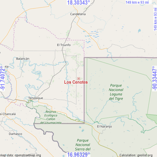
Los Cenotes GPS coordinates[2]
17° 38' 4.596" North, 91° 2' 15.324" West
| Map corner | latitude | longitude |
|---|---|---|
| Upper-left | 18.30343°, | -91.74072° |
| Center: | 17.63461°, | -91.03759° |
| Lower-right: | 16.96329°, | -90.33447° |
| Map W x H: | 149×149 km | = 92.6×92.6mi |
| max Lat: | 32.7° ⇑81.9% North |
| Los Cenotes: | 17.63461° |
| min Lat: | ⇓18.1% South 14.53588° |
| min Long | Los Cenotes | max Long |
| -117.105° | -91.03759° | -86.73105° |
| W 96.8%⇐ | ⇒3.2% E |
Elevation
Elevation of Los Cenotes is 51 m = 167 ft, and this is 1202.7 m = 3946 ft below average elevation for this country.
| Max E: |
3497 m = 11473 ft | 84.1% |
| Avg. | 1253.7 m = 4113 ft | |
| Los Cenotes | 51 m = 167 ft | |
Min E: |
-1 m = -3 ft | 15.9% |
See also: Mexico elevation on elevation.city.
Geographical zone
Los Cenotes is located in North Torrid zone (between Equator and Tropic of Cancer). Distance of this Northern Tropic circle is 645.1 km =400.8 mi to North.| Distance of | km | miles | from Los Cenotes |
|---|---|---|---|
| North Pole | 8046.3 | 4999.7 | to North |
| Arctic Circle | 5440.4 | 3380.5 | to North |
| Tropic Cancer | 645.1 | 400.8 | to North |
| Equator | 1960.8 | 1218.4 | to South |


Nearby cities:
15 places around Los Cenotes: (largest is in red/bold)
• Apatzingán
4.3 km =2.7 mi,  226°
226°
• Capitán Felipe Castellanos Díaz (San Pedro)
19.3 km =12 mi,  322°
322°
• Cuauhtémoc
22.1 km =13.7 mi,  355°
355°
• El Capulín
9.6 km =6 mi,  326°
326°
• El Chamizal
15.4 km =9.6 mi,  187°
187°
• El Mical
22.1 km =13.7 mi,  353°
353°
• El Naranjito
25.2 km =15.7 mi, 332°
• El Palmar
20.7 km =12.9 mi,  180°
180°
• El Águila
24.1 km =15 mi,  275°
275°
• Ingeniero Emilio López Zamora
21.6 km =13.4 mi, 353°
• Jolochero
12.9 km =8 mi,  198°
198°
• Paraíso (El Tinto)
12.4 km =7.7 mi,  244°
244°
• Quetzalcóatl (Cuatro Poblados)
21.7 km =13.5 mi, 354°
• San Carlos
15.4 km =9.6 mi, 233°
• Santa Cruz
24.1 km =15 mi, 176°
Sources, notices
• [Note1] Compared only with cities in Mexico existing in our database
• [Src1] Map data: © OpenStreetMap contributors (CC-BY-SA)
• [Src2] Other city data from geonames.org with taken over terms of usage.
• [Src3] Geographical zone / Annual Mean Temperature by Robert A. Rohde @ Wikipedia
