Nueva Providencia geodata
Nueva Providencia (Chiapas) is a populated place; located in Mexico in America/Mexico_City (GMT-6) time zone. With population of 729 people, there are 11976 cities with bigger population in this country. Compared to other cities in Mexico, 95.1% of cities are located further ↑North; 96.5% of cities are located further ←West and 74.5% of cities have higher elevation than Nueva Providencia. Note1


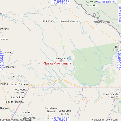
Nueva Providencia GPS coordinates[2]
16° 22' 42.78" North, 91° 21' 47.88" West
| Map corner | latitude | longitude |
|---|---|---|
| Upper-left | 17.05196°, | -92.06643° |
| Center: | 16.37855°, | -91.3633° |
| Lower-right: | 15.70281°, | -90.66018° |
| Map W x H: | 150×150 km | = 93.2×93.2mi |
| max Lat: | 32.7° ⇑95.1% North |
| Nueva Providencia: | 16.37855° |
| min Lat: | ⇓4.9% South 14.53588° |
| min Long | Nueva Providenc | max Long |
| -117.105° | -91.3633° | -86.73105° |
| W 96.5%⇐ | ⇒3.5% E |
Elevation
Elevation of Nueva Providencia is 236 m = 774 ft, and this is 1017.7 m = 3339 ft below average elevation for this country.
| Max E: |
3497 m = 11473 ft | 74.5% |
| Avg. | 1253.7 m = 4113 ft | |
| Nueva Providencia | 236 m = 774 ft | |
Min E: |
-1 m = -3 ft | 25.5% |
See also: Mexico elevation on elevation.city.
Geographical zone
Nueva Providencia is located in North Torrid zone (between Equator and Tropic of Cancer). Distance of this Northern Tropic circle is 784.8 km =487.7 mi to North.| Distance of | km | miles | from Nueva Providencia |
|---|---|---|---|
| North Pole | 8185.9 | 5086.5 | to North |
| Arctic Circle | 5580.1 | 3467.3 | to North |
| Tropic Cancer | 784.8 | 487.7 | to North |
| Equator | 1821.1 | 1131.6 | to South |


Nearby cities:
15 places around Nueva Providencia: (largest is in red/bold)
• Amador Hernández
18 km =11.2 mi,  10°
10°
• Emiliano Zapata
3 km =1.9 mi,  48°
48°
• Jerusalén
22.2 km =13.8 mi,  184°
184°
• La Soledad
17.1 km =10.6 mi,  328°
328°
• Nueva Sabanilla
19.7 km =12.2 mi,  129°
129°
• Nuevo Poza Rica
24.4 km =15.2 mi,  191°
191°
• Nuevo Rodulfo Figueroa
20.6 km =12.8 mi,  148°
148°
• Nuevo Santo Tomás
20.1 km =12.5 mi, 194°
• Plan de Santo Tomás
23.7 km =14.7 mi,  279°
279°
• Ramón F. Balboa
11.5 km =7.1 mi,  338°
338°
• San Antonio los Montes
24 km =14.9 mi,  218°
218°
• San Bartolo (El Puerto)
20.3 km =12.6 mi,  321°
321°
• San Quintín
3.6 km =2.2 mi,  30°
30°
• Santa Lucía Ojo de Agua
21.7 km =13.5 mi,  273°
273°
• Santa Rita Invernadero
18 km =11.2 mi, 282°
Sources, notices
• [Note1] Compared only with cities in Mexico existing in our database
• [Src1] Map data: © OpenStreetMap contributors (CC-BY-SA)
• [Src2] Other city data from geonames.org with taken over terms of usage.
• [Src3] Geographical zone / Annual Mean Temperature by Robert A. Rohde @ Wikipedia
