Morelos Cañada geodata
Morelos Cañada (Puebla) is a seat of a second-order administrative division; located in Mexico in America/Mexico_City (GMT-6) time zone. With population of 4,121 people, there are 2220 cities with bigger population in this country. Compared to other cities in Mexico, 69.8% of cities are located further ↑North; 70.4% of cities are located further ←West and 86.6% of cities have lower elevation than Morelos Cañada. Note1


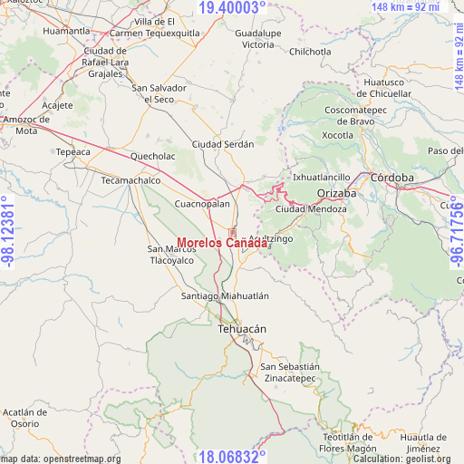
Morelos Cañada GPS coordinates[2]
18° 44' 7.764" North, 97° 25' 14.448" West
| Map corner | latitude | longitude |
|---|---|---|
| Upper-left | 19.40003°, | -98.12381° |
| Center: | 18.73549°, | -97.42068° |
| Lower-right: | 18.06832°, | -96.71756° |
| Map W x H: | 148.1×148.1 km | = 92×92mi |
| max Lat: | 32.7° ⇑69.8% North |
| Morelos Cañada: | 18.73549° |
| min Lat: | ⇓30.2% South 14.53588° |
| min Long | Morelos Cañada | max Long |
| -117.105° | -97.42068° | -86.73105° |
| W 70.4%⇐ | ⇒29.6% E |
Elevation
Elevation of Morelos Cañada is 2297 m = 7536 ft, and this is 1043.3 m = 3423 ft above average elevation for this country.
| Max E: |
3497 m = 11473 ft | 13.4% |
| Morelos Cañada | 2297 m 7536 ft | |
| Avg. | 1253.7 m = 4113 ft | |
Min E: |
-1 m = -3 ft | 86.6% |
See also: Mexico elevation on elevation.city.
Geographical zone
Morelos Cañada is located in North Torrid zone (between Equator and Tropic of Cancer). Distance of this Northern Tropic circle is 522.7 km =324.8 mi to North.| Distance of | km | miles | from Morelos Cañada |
|---|---|---|---|
| North Pole | 7923.9 | 4923.7 | to North |
| Arctic Circle | 5318 | 3304.5 | to North |
| Tropic Cancer | 522.7 | 324.8 | to North |
| Equator | 2083.2 | 1294.4 | to South |


Nearby cities:
15 places around Morelos Cañada: (largest is in red/bold)
• Azumbilla
10.3 km =6.4 mi,  166°
166°
• Barrio la Soledad
6.8 km =4.2 mi,  6°
6°
• Boca Nopal
7.6 km =4.7 mi,  72°
72°
• Buena Vista
4.8 km =3 mi,  78°
78°
• Cerro Gordo
2.9 km =1.8 mi,  105°
105°
• Guadalupe Fresnal
8 km =5 mi,  61°
61°
• Guadalupe Piletas
9.2 km =5.7 mi,  3°
3°
• Los Garcías
8 km =5 mi,  20°
20°
• Puente Colorado
7.2 km =4.5 mi,  118°
118°
• Puerta Cañada
8.9 km =5.5 mi, 7°
• San Antonio Soledad
5.6 km =3.5 mi, 14°
• San José Ixtapa
4.6 km =2.9 mi,  241°
241°
• Tehuitzo
10 km =6.2 mi,  349°
349°
• Temaxcalapa
6.2 km =3.9 mi, 64°
• Tezuapan (San Isidro)
3.5 km =2.2 mi,  27°
27°
Sources, notices
• [Note1] Compared only with cities in Mexico existing in our database
• [Src1] Map data: © OpenStreetMap contributors (CC-BY-SA)
• [Src2] Other city data from geonames.org with taken over terms of usage.
• [Src3] Geographical zone / Annual Mean Temperature by Robert A. Rohde @ Wikipedia
