Cerro Gordo geodata
Cerro Gordo (Puebla) is a populated place; located in Mexico in America/Mexico_City (GMT-6) time zone. With population of 531 people, there are 15939 cities with bigger population in this country. Compared to other cities in Mexico, 69.9% of cities are located further ↑North; 70.6% of cities are located further ←West and 89.3% of cities have lower elevation than Cerro Gordo. Note1


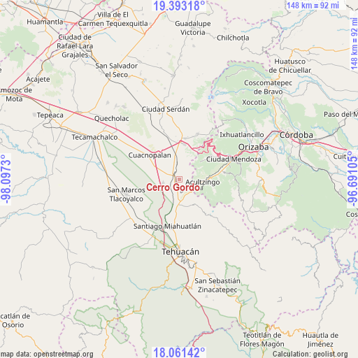
Cerro Gordo GPS coordinates[2]
18° 43' 42.996" North, 97° 23' 39.012" West
| Map corner | latitude | longitude |
|---|---|---|
| Upper-left | 19.39318°, | -98.0973° |
| Center: | 18.72861°, | -97.39417° |
| Lower-right: | 18.06142°, | -96.69105° |
| Map W x H: | 148.1×148.1 km | = 92×92mi |
| max Lat: | 32.7° ⇑69.9% North |
| Cerro Gordo: | 18.72861° |
| min Lat: | ⇓30.1% South 14.53588° |
| min Long | Cerro Gordo | max Long |
| -117.105° | -97.39417° | -86.73105° |
| W 70.6%⇐ | ⇒29.4% E |
Elevation
Elevation of Cerro Gordo is 2382 m = 7815 ft, and this is 1128.3 m = 3702 ft above average elevation for this country.
| Max E: |
3497 m = 11473 ft | 10.7% |
| Cerro Gordo | 2382 m 7815 ft | |
| Avg. | 1253.7 m = 4113 ft | |
Min E: |
-1 m = -3 ft | 89.3% |
See also: Mexico elevation on elevation.city.
Geographical zone
Cerro Gordo is located in North Torrid zone (between Equator and Tropic of Cancer). Distance of this Northern Tropic circle is 523.5 km =325.3 mi to North.| Distance of | km | miles | from Cerro Gordo |
|---|---|---|---|
| North Pole | 7924.6 | 4924.1 | to North |
| Arctic Circle | 5318.7 | 3304.9 | to North |
| Tropic Cancer | 523.5 | 325.3 | to North |
| Equator | 2082.4 | 1293.9 | to South |


Nearby cities:
15 places around Cerro Gordo: (largest is in red/bold)
• Acultzingo
9.6 km =6 mi,  96°
96°
• Azumbilla
9.2 km =5.7 mi,  182°
182°
• Barrio la Soledad
7.7 km =4.8 mi,  344°
344°
• Boca Nopal
5.4 km =3.4 mi,  55°
55°
• Buena Vista
2.6 km =1.6 mi,  47°
47°
• Guadalupe Fresnal
6.3 km =3.9 mi,  42°
42°
• Huiloapan
8.5 km =5.3 mi,  73°
73°
• Los Garcías
8.3 km =5.2 mi,  0°
0°
• Morelos Cañada
2.9 km =1.8 mi,  285°
285°
• Puente Colorado
4.5 km =2.8 mi,  127°
127°
• Puerta Cañada
9.8 km =6.1 mi,  350°
350°
• San Antonio Soledad
6.3 km =3.9 mi, 347°
• San José Ixtapa
7 km =4.3 mi,  258°
258°
• Temaxcalapa
4.4 km =2.7 mi, 39°
• Tezuapan (San Isidro)
4.1 km =2.5 mi, 343°
Sources, notices
• [Note1] Compared only with cities in Mexico existing in our database
• [Src1] Map data: © OpenStreetMap contributors (CC-BY-SA)
• [Src2] Other city data from geonames.org with taken over terms of usage.
• [Src3] Geographical zone / Annual Mean Temperature by Robert A. Rohde @ Wikipedia
