Los Cacaos geodata
Los Cacaos (Chiapas) is a populated place; located in Mexico in America/Mexico_City (GMT-6) time zone. With population of 845 people, there are 10356 cities with bigger population in this country. Compared to other cities in Mexico, 98.7% of cities are located further ↑North; 90.8% of cities are located further ←West and 69.3% of cities have higher elevation than Los Cacaos. Note1


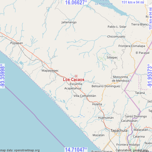
Los Cacaos GPS coordinates[2]
15° 23' 22.092" North, 92° 39' 24.66" West
| Map corner | latitude | longitude |
|---|---|---|
| Upper-left | 16.06627°, | -93.35998° |
| Center: | 15.38947°, | -92.65685° |
| Lower-right: | 14.71047°, | -91.95373° |
| Map W x H: | 150.8×150.8 km | = 93.7×93.7mi |
| max Lat: | 32.7° ⇑98.7% North |
| Los Cacaos: | 15.38947° |
| min Lat: | ⇓1.3% South 14.53588° |
| min Long | Los Cacaos | max Long |
| -117.105° | -92.65685° | -86.73105° |
| W 90.8%⇐ | ⇒9.2% E |
Elevation
Elevation of Los Cacaos is 453 m = 1486 ft, and this is 800.7 m = 2627 ft below average elevation for this country.
| Max E: |
3497 m = 11473 ft | 69.3% |
| Avg. | 1253.7 m = 4113 ft | |
| Los Cacaos | 453 m = 1486 ft | |
Min E: |
-1 m = -3 ft | 30.7% |
See also: Mexico elevation on elevation.city.
Geographical zone
Los Cacaos is located in North Torrid zone (between Equator and Tropic of Cancer). Distance of this Northern Tropic circle is 894.8 km =556 mi to North.| Distance of | km | miles | from Los Cacaos |
|---|---|---|---|
| North Pole | 8295.9 | 5154.8 | to North |
| Arctic Circle | 5690 | 3535.6 | to North |
| Tropic Cancer | 894.8 | 556 | to North |
| Equator | 1711.1 | 1063.2 | to South |


Nearby cities:
15 places around Los Cacaos: (largest is in red/bold)
• Acacoyagua
5.8 km =3.6 mi,  199°
199°
• Acapetahua
12.5 km =7.8 mi, 196°
• Cintalapa
7.2 km =4.5 mi,  142°
142°
• El Madronal
13 km =8.1 mi, 204°
• El Triunfo
12.7 km =7.9 mi,  110°
110°
• Escuintla
7.8 km =4.8 mi,  181°
181°
• Hidalgo
10.1 km =6.3 mi,  244°
244°
• Jalapa
4.6 km =2.9 mi,  214°
214°
• Jiquilpan (Estación Bonanza)
11.1 km =6.9 mi, 241°
• La Independencia
9.5 km =5.9 mi,  117°
117°
• Los Amates
6.2 km =3.9 mi,  219°
219°
• Monte Flor Arriba
12 km =7.5 mi,  129°
129°
• Nueva Libertad
5.6 km =3.5 mi,  290°
290°
• San Felipe Tizapa
13.4 km =8.3 mi,  159°
159°
• Soconusco
11.1 km =6.9 mi, 222°
Sources, notices
• [Note1] Compared only with cities in Mexico existing in our database
• [Src1] Map data: © OpenStreetMap contributors (CC-BY-SA)
• [Src2] Other city data from geonames.org with taken over terms of usage.
• [Src3] Geographical zone / Annual Mean Temperature by Robert A. Rohde @ Wikipedia
