Jalapa geodata
Jalapa (Chiapas) is a populated place; located in Mexico in America/Mexico_City (GMT-6) time zone. With population of 849 people, there are 10304 cities with bigger population in this country. Compared to other cities in Mexico, 98.8% of cities are located further ↑North; 90.7% of cities are located further ←West and 80.2% of cities have higher elevation than Jalapa. Note1


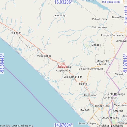
Jalapa GPS coordinates[2]
15° 21' 18.54" North, 92° 40' 52.68" West
| Map corner | latitude | longitude |
|---|---|---|
| Upper-left | 16.03206°, | -93.38443° |
| Center: | 15.35515°, | -92.6813° |
| Lower-right: | 14.67604°, | -91.97818° |
| Map W x H: | 150.8×150.8 km | = 93.7×93.7mi |
| max Lat: | 32.7° ⇑98.8% North |
| Jalapa: | 15.35515° |
| min Lat: | ⇓1.2% South 14.53588° |
| min Long | Jalapa | max Long |
| -117.105° | -92.6813° | -86.73105° |
| W 90.7%⇐ | ⇒9.3% E |
Elevation
Elevation of Jalapa is 92 m = 302 ft, and this is 1161.7 m = 3811 ft below average elevation for this country.
| Max E: |
3497 m = 11473 ft | 80.2% |
| Avg. | 1253.7 m = 4113 ft | |
| Jalapa | 92 m = 302 ft | |
Min E: |
-1 m = -3 ft | 19.8% |
See also: Mexico elevation on elevation.city.
Geographical zone
Jalapa is located in North Torrid zone (between Equator and Tropic of Cancer). Distance of this Northern Tropic circle is 898.6 km =558.4 mi to North.| Distance of | km | miles | from Jalapa |
|---|---|---|---|
| North Pole | 8299.7 | 5157.2 | to North |
| Arctic Circle | 5693.8 | 3538 | to North |
| Tropic Cancer | 898.6 | 558.4 | to North |
| Equator | 1707.3 | 1060.9 | to South |


Nearby cities:
15 places around Jalapa: (largest is in red/bold)
• Acacoyagua
1.8 km =1.1 mi,  158°
158°
• Acapetahua
8.2 km =5.1 mi,  186°
186°
• Cintalapa
7.3 km =4.5 mi,  105°
105°
• El Madronal
8.5 km =5.3 mi,  198°
198°
• Escuintla
4.7 km =2.9 mi,  148°
148°
• Hidalgo
6.5 km =4 mi,  264°
264°
• Jiquilpan (Estación Bonanza)
7.2 km =4.5 mi, 258°
• La Independencia
11 km =6.8 mi,  93°
93°
• Las Cruces
9.8 km =6.1 mi,  211°
211°
• Los Amates
1.6 km =1 mi,  232°
232°
• Los Cacaos
4.6 km =2.9 mi,  34°
34°
• Monte Flor Arriba
12.4 km =7.7 mi, 108°
• Nueva Libertad
6.3 km =3.9 mi,  335°
335°
• San Felipe Tizapa
11.4 km =7.1 mi,  140°
140°
• Soconusco
6.6 km =4.1 mi, 227°
Sources, notices
• [Note1] Compared only with cities in Mexico existing in our database
• [Src1] Map data: © OpenStreetMap contributors (CC-BY-SA)
• [Src2] Other city data from geonames.org with taken over terms of usage.
• [Src3] Geographical zone / Annual Mean Temperature by Robert A. Rohde @ Wikipedia
