Acacoyagua geodata
Acacoyagua (Chiapas) is a seat of a second-order administrative division; located in Mexico in America/Mexico_City (GMT-6) time zone. With population of 7,515 people, there are 1243 cities with bigger population in this country. Compared to other cities in Mexico, 98.8% of cities are located further ↑North; 90.7% of cities are located further ←West and 80.3% of cities have higher elevation than Acacoyagua. Note1


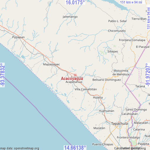
Acacoyagua GPS coordinates[2]
15° 20' 25.944" North, 92° 40' 30.684" West
| Map corner | latitude | longitude |
|---|---|---|
| Upper-left | 16.0175°, | -93.37832° |
| Center: | 15.34054°, | -92.67519° |
| Lower-right: | 14.66138°, | -91.97207° |
| Map W x H: | 150.8×150.8 km | = 93.7×93.7mi |
| max Lat: | 32.7° ⇑98.8% North |
| Acacoyagua: | 15.34054° |
| min Lat: | ⇓1.2% South 14.53588° |
| min Long | Acacoyagua | max Long |
| -117.105° | -92.67519° | -86.73105° |
| W 90.7%⇐ | ⇒9.3% E |
Elevation
Elevation of Acacoyagua is 90 m = 295 ft, and this is 1163.7 m = 3818 ft below average elevation for this country.
| Max E: |
3497 m = 11473 ft | 80.3% |
| Avg. | 1253.7 m = 4113 ft | |
| Acacoyagua | 90 m = 295 ft | |
Min E: |
-1 m = -3 ft | 19.7% |
See also: Mexico elevation on elevation.city.
Geographical zone
Acacoyagua is located in North Torrid zone (between Equator and Tropic of Cancer). Distance of this Northern Tropic circle is 900.2 km =559.4 mi to North.| Distance of | km | miles | from Acacoyagua |
|---|---|---|---|
| North Pole | 8301.4 | 5158.2 | to North |
| Arctic Circle | 5695.5 | 3539 | to North |
| Tropic Cancer | 900.2 | 559.4 | to North |
| Equator | 1705.7 | 1059.9 | to South |


Nearby cities:
15 places around Acacoyagua: (largest is in red/bold)
• Acapetahua
6.7 km =4.2 mi,  193°
193°
• Barrio Nuevo
10.8 km =6.7 mi, 189°
• Cintalapa
6.4 km =4 mi,  92°
92°
• El Madronal
7.3 km =4.5 mi,  207°
207°
• Escuintla
3 km =1.9 mi,  142°
142°
• Hidalgo
7.2 km =4.5 mi,  278°
278°
• Jalapa
1.8 km =1.1 mi,  338°
338°
• Jiquilpan (Estación Bonanza)
7.8 km =4.8 mi,  271°
271°
• La Independencia
10.4 km =6.5 mi,  84°
84°
• Las Cruces
8.9 km =5.5 mi,  220°
220°
• Los Amates
2 km =1.2 mi,  287°
287°
• Los Cacaos
5.8 km =3.6 mi,  19°
19°
• Nueva Libertad
8.1 km =5 mi, 336°
• San Felipe Tizapa
9.8 km =6.1 mi, 137°
• Soconusco
6.2 km =3.9 mi,  242°
242°
Sources, notices
• [Note1] Compared only with cities in Mexico existing in our database
• [Src1] Map data: © OpenStreetMap contributors (CC-BY-SA)
• [Src2] Other city data from geonames.org with taken over terms of usage.
• [Src3] Geographical zone / Annual Mean Temperature by Robert A. Rohde @ Wikipedia
