La Independencia geodata
La Independencia (Chiapas) is a populated place; located in Mexico in America/Mexico_City (GMT-6) time zone. With population of 957 people, there are 9106 cities with bigger population in this country. Compared to other cities in Mexico, 98.8% of cities are located further ↑North; 91.3% of cities are located further ←West and 74.5% of cities have higher elevation than La Independencia. Note1


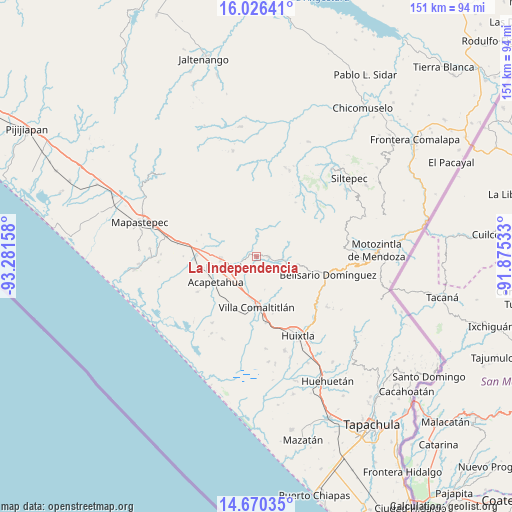
La Independencia GPS coordinates[2]
15° 20' 58.128" North, 92° 34' 42.42" West
| Map corner | latitude | longitude |
|---|---|---|
| Upper-left | 16.02641°, | -93.28158° |
| Center: | 15.34948°, | -92.57845° |
| Lower-right: | 14.67035°, | -91.87533° |
| Map W x H: | 150.8×150.8 km | = 93.7×93.7mi |
| max Lat: | 32.7° ⇑98.8% North |
| La Independencia: | 15.34948° |
| min Lat: | ⇓1.2% South 14.53588° |
| min Long | La Independenci | max Long |
| -117.105° | -92.57845° | -86.73105° |
| W 91.3%⇐ | ⇒8.7% E |
Elevation
Elevation of La Independencia is 237 m = 778 ft, and this is 1016.7 m = 3336 ft below average elevation for this country.
| Max E: |
3497 m = 11473 ft | 74.5% |
| Avg. | 1253.7 m = 4113 ft | |
| La Independencia | 237 m = 778 ft | |
Min E: |
-1 m = -3 ft | 25.5% |
See also: Mexico elevation on elevation.city.
Geographical zone
La Independencia is located in North Torrid zone (between Equator and Tropic of Cancer). Distance of this Northern Tropic circle is 899.2 km =558.7 mi to North.| Distance of | km | miles | from La Independencia |
|---|---|---|---|
| North Pole | 8300.4 | 5157.6 | to North |
| Arctic Circle | 5694.5 | 3538.4 | to North |
| Tropic Cancer | 899.2 | 558.7 | to North |
| Equator | 1706.7 | 1060.5 | to South |


Nearby cities:
15 places around La Independencia: (largest is in red/bold)
• Acacoyagua
10.4 km =6.5 mi,  264°
264°
• Acapetahua
14.1 km =8.8 mi,  237°
237°
• Cintalapa
4.2 km =2.6 mi,  252°
252°
• El Madronal
15.6 km =9.7 mi, 241°
• El Triunfo
3.5 km =2.2 mi,  89°
89°
• Escuintla
9.2 km =5.7 mi, 248°
• Jalapa
11 km =6.8 mi,  273°
273°
• Los Amates
12.3 km =7.6 mi, 268°
• Los Cacaos
9.5 km =5.9 mi,  297°
297°
• Monte Flor Arriba
3.3 km =2.1 mi,  166°
166°
• Nueva Libertad
15.1 km =9.4 mi, 295°
• San Felipe Tizapa
9 km =5.6 mi,  204°
204°
• Unión Jamaica
5.8 km =3.6 mi,  102°
102°
• Vicente Guerrero
10.1 km =6.3 mi, 165°
• Villa Comaltitlán
15.1 km =9.4 mi,  179°
179°
Sources, notices
• [Note1] Compared only with cities in Mexico existing in our database
• [Src1] Map data: © OpenStreetMap contributors (CC-BY-SA)
• [Src2] Other city data from geonames.org with taken over terms of usage.
• [Src3] Geographical zone / Annual Mean Temperature by Robert A. Rohde @ Wikipedia
