Los Altos geodata
Los Altos (Veracruz) is a populated place; located in Mexico in America/Mexico_City (GMT-6) time zone. With population of 4,771 people, there are 1936 cities with bigger population in this country. Compared to other cities in Mexico, 81.4% of cities are located further ↓South; 66.6% of cities are located further ←West and 91.6% of cities have higher elevation than Los Altos. Note1


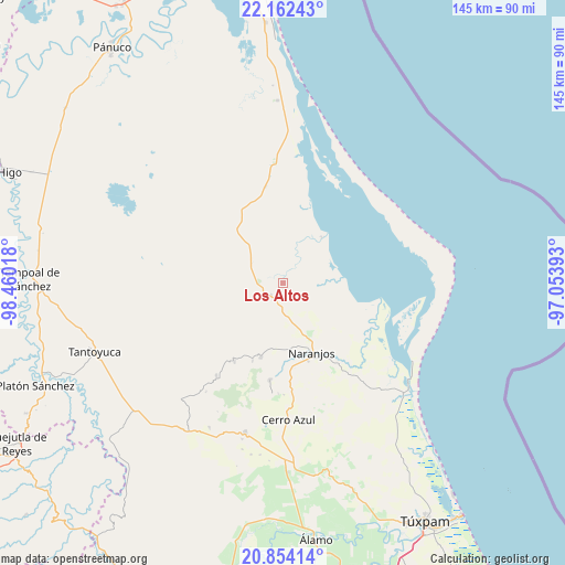
Los Altos GPS coordinates[2]
21° 30' 35.136" North, 97° 45' 25.38" West
| Map corner | latitude | longitude |
|---|---|---|
| Upper-left | 22.16243°, | -98.46018° |
| Center: | 21.50976°, | -97.75705° |
| Lower-right: | 20.85414°, | -97.05393° |
| Map W x H: | 145.5×145.5 km | = 90.4×90.4mi |
| max Lat: | 32.7° ⇑18.6% North |
| Los Altos: | 21.50976° |
| min Lat: | ⇓81.4% South 14.53588° |
| min Long | Los Altos | max Long |
| -117.105° | -97.75705° | -86.73105° |
| W 66.6%⇐ | ⇒33.4% E |
Elevation
Elevation of Los Altos is 20 m = 66 ft, and this is 1233.7 m = 4048 ft below average elevation for this country.
| Max E: |
3497 m = 11473 ft | 91.6% |
| Avg. | 1253.7 m = 4113 ft | |
| Los Altos | 20 m = 66 ft | |
Min E: |
-1 m = -3 ft | 8.4% |
See also: Mexico elevation on elevation.city.
Geographical zone
Los Altos is located in North Torrid zone (between Equator and Tropic of Cancer). Distance of this Northern Tropic circle is 214.3 km =133.2 mi to North.| Distance of | km | miles | from Los Altos |
|---|---|---|---|
| North Pole | 7615.4 | 4732 | to North |
| Arctic Circle | 5009.5 | 3112.8 | to North |
| Tropic Cancer | 214.3 | 133.2 | to North |
| Equator | 2391.7 | 1486.1 | to South |


Nearby cities:
15 places around Los Altos: (largest is in red/bold)
• Amatlán
19.4 km =12.1 mi,  179°
179°
• Carmona y Valle
17.1 km =10.6 mi,  193°
193°
• Cervantes
20.2 km =12.6 mi,  165°
165°
• Chinampa de Gorostiza
16.9 km =10.5 mi, 172°
• Colonia las Flores
17.7 km =11 mi,  158°
158°
• Cucharas
15.4 km =9.6 mi,  40°
40°
• El Zapotal
4.5 km =2.8 mi,  219°
219°
• Gutiérrez Zamora
16.3 km =10.1 mi,  195°
195°
• Mamey la Mar
11.4 km =7.1 mi,  84°
84°
• Naranjos
19.1 km =11.9 mi, 157°
• Ozuluama de Mascareñas
19.3 km =12 mi,  330°
330°
• Rancho Nuevo
21.3 km =13.2 mi, 155°
• Rancho Nuevo
22.2 km =13.8 mi, 222°
• Tamalín
19.8 km =12.3 mi, 196°
• Tantima
21.3 km =13.2 mi, 201°
Sources, notices
• [Note1] Compared only with cities in Mexico existing in our database
• [Src1] Map data: © OpenStreetMap contributors (CC-BY-SA)
• [Src2] Other city data from geonames.org with taken over terms of usage.
• [Src3] Geographical zone / Annual Mean Temperature by Robert A. Rohde @ Wikipedia
