Chinampa de Gorostiza geodata
Chinampa de Gorostiza (Veracruz) is a seat of a second-order administrative division; located in Mexico in America/Mexico_City (GMT-6) time zone. With population of 5,317 people, there are 1741 cities with bigger population in this country. Compared to other cities in Mexico, 80.5% of cities are located further ↓South; 66.8% of cities are located further ←West and 79.3% of cities have higher elevation than Chinampa de Gorostiza. Note1
Current local time in Chinampa de Gorostiza:
08:32 AM, WednesdayDifference from your time zone: hours


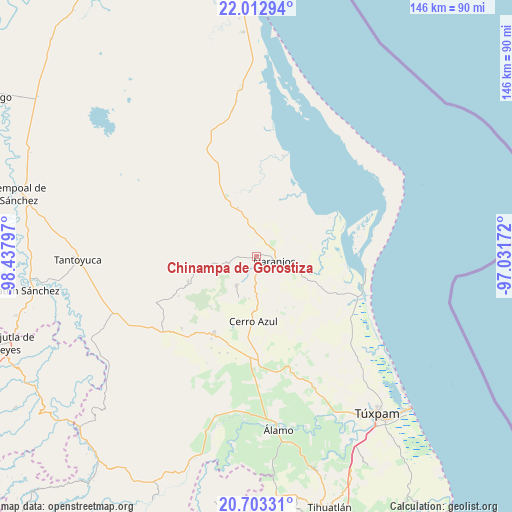
Chinampa de Gorostiza GPS coordinates[2]
21° 21' 34.524" North, 97° 44' 5.424" West
| Map corner | latitude | longitude |
|---|---|---|
| Upper-left | 22.01294°, | -98.43797° |
| Center: | 21.35959°, | -97.73484° |
| Lower-right: | 20.70331°, | -97.03172° |
| Map W x H: | 145.6×145.6 km | = 90.5×90.5mi |
| max Lat: | 32.7° ⇑19.5% North |
| Chinampa de Gorostiza: | 21.35959° |
| min Lat: | ⇓80.5% South 14.53588° |
| min Long | Chinampa de Gor | max Long |
| -117.105° | -97.73484° | -86.73105° |
| W 66.8%⇐ | ⇒33.2% E |
Elevation
Elevation of Chinampa de Gorostiza is 106 m = 348 ft, and this is 1147.7 m = 3765 ft below average elevation for this country.
| Max E: |
3497 m = 11473 ft | 79.3% |
| Avg. | 1253.7 m = 4113 ft | |
| Chinampa de Gorostiza | 106 m = 348 ft | |
Min E: |
-1 m = -3 ft | 20.7% |
See also: Mexico elevation on elevation.city.
Geographical zone
Chinampa de Gorostiza is located in North Torrid zone (between Equator and Tropic of Cancer). Distance of this Northern Tropic circle is 231 km =143.5 mi to North.| Distance of | km | miles | from Chinampa de Gorostiza |
|---|---|---|---|
| North Pole | 7632.1 | 4742.4 | to North |
| Arctic Circle | 5026.2 | 3123.1 | to North |
| Tropic Cancer | 231 | 143.5 | to North |
| Equator | 2375 | 1475.8 | to South |


Nearby cities:
15 places around Chinampa de Gorostiza: (largest is in red/bold)
• Amatlán
3.6 km =2.2 mi,  220°
220°
• Carmona y Valle
6.3 km =3.9 mi,  270°
270°
• Cervantes
4 km =2.5 mi,  135°
135°
• Colonia las Flores
4.3 km =2.7 mi,  86°
86°
• El Anono
14.1 km =8.8 mi, 144°
• El Zapotal
14.2 km =8.8 mi,  338°
338°
• Galeana
8.9 km =5.5 mi,  149°
149°
• Gutiérrez Zamora
6.7 km =4.2 mi,  278°
278°
• La Pimienta
12.5 km =7.8 mi, 90°
• Naranjos
5.1 km =3.2 mi,  100°
100°
• Rancho Nuevo
7 km =4.3 mi,  112°
112°
• Tamalín
8.3 km =5.2 mi,  254°
254°
• Tancoco
10 km =6.2 mi, 215°
• Tantima
10.6 km =6.6 mi, 253°
• Zacamixtle
12.5 km =7.8 mi,  173°
173°
Sources, notices
• [Note1] Compared only with cities in Mexico existing in our database
• [Src1] Map data: © OpenStreetMap contributors (CC-BY-SA)
• [Src2] Other city data from geonames.org with taken over terms of usage.
• [Src3] Geographical zone / Annual Mean Temperature by Robert A. Rohde @ Wikipedia
