Tamalín geodata
Tamalín (Veracruz) is a seat of a second-order administrative division; located in Mexico in America/Mexico_City (GMT-6) time zone. With population of 5,019 people, there are 1839 cities with bigger population in this country. Compared to other cities in Mexico, 80.4% of cities are located further ↓South; 65.9% of cities are located further ←West and 77.3% of cities have higher elevation than Tamalín. Note1


Tamalín GPS coordinates[2]
21° 20' 21.696" North, 97° 48' 42.768" West
| Map corner | latitude | longitude |
|---|---|---|
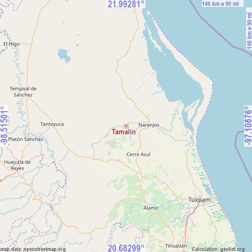
| Upper-left | 21.99281°, | -98.51501° |
| Center: | 21.33936°, | -97.81188° |
| Lower-right: | 20.68299°, | -97.10876° |
| Map W x H: | 145.6×145.6 km | = 90.5×90.5mi |
| max Lat: | 32.7° ⇑19.6% North |
| Tamalín: | 21.33936° |
| min Lat: | ⇓80.4% South 14.53588° |
| min Long | Tamalín | max Long |
| -117.105° | -97.81188° | -86.73105° |
| W 65.9%⇐ | ⇒34.1% E |
Elevation
Elevation of Tamalín is 147 m = 482 ft, and this is 1106.7 m = 3631 ft below average elevation for this country.
| Max E: |
3497 m = 11473 ft | 77.3% |
| Avg. | 1253.7 m = 4113 ft | |
| Tamalín | 147 m = 482 ft | |
Min E: |
-1 m = -3 ft | 22.7% |
See also: Mexico elevation on elevation.city.
Geographical zone
Tamalín is located in North Torrid zone (between Equator and Tropic of Cancer). Distance of this Northern Tropic circle is 233.2 km =144.9 mi to North.| Distance of | km | miles | from Tamalín |
|---|---|---|---|
| North Pole | 7634.3 | 4743.7 | to North |
| Arctic Circle | 5028.5 | 3124.6 | to North |
| Tropic Cancer | 233.2 | 144.9 | to North |
| Equator | 2372.7 | 1474.3 | to South |


Nearby cities:
15 places around Tamalín: (largest is in red/bold)
• Amatlán
5.7 km =3.5 mi,  94°
94°
• Carmona y Valle
2.9 km =1.8 mi,  35°
35°
• Cervantes
10.8 km =6.7 mi, 93°
• Chinampa de Gorostiza
8.3 km =5.2 mi,  74°
74°
• Chontla
12.6 km =7.8 mi,  247°
247°
• Citlaltépec
7 km =4.3 mi,  260°
260°
• Colonia las Flores
12.6 km =7.8 mi,  78°
78°
• El Naranjal
8.2 km =5.1 mi,  265°
265°
• Gutiérrez Zamora
3.5 km =2.2 mi,  23°
23°
• La Garita
11.4 km =7.1 mi, 256°
• Las Sabinas
7.5 km =4.7 mi, 251°
• Naranjos
13 km =8.1 mi, 84°
• Rancho Nuevo
9.5 km =5.9 mi,  284°
284°
• Tancoco
6.3 km =3.9 mi,  160°
160°
• Tantima
2.4 km =1.5 mi, 250°
Sources, notices
• [Note1] Compared only with cities in Mexico existing in our database
• [Src1] Map data: © OpenStreetMap contributors (CC-BY-SA)
• [Src2] Other city data from geonames.org with taken over terms of usage.
• [Src3] Geographical zone / Annual Mean Temperature by Robert A. Rohde @ Wikipedia
