Colonia las Flores geodata
Colonia las Flores (Veracruz) is a populated place; located in Mexico in America/Mexico_City (GMT-6) time zone. With population of 2,959 people, there are 3028 cities with bigger population in this country. Compared to other cities in Mexico, 80.5% of cities are located further ↓South; 67.3% of cities are located further ←West and 83.1% of cities have higher elevation than Colonia las Flores. Note1


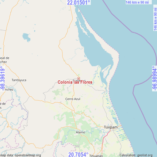
Colonia las Flores GPS coordinates[2]
21° 21' 42.012" North, 97° 41' 35.016" West
| Map corner | latitude | longitude |
|---|---|---|
| Upper-left | 22.01501°, | -98.39619° |
| Center: | 21.36167°, | -97.69306° |
| Lower-right: | 20.7054°, | -96.98994° |
| Map W x H: | 145.6×145.6 km | = 90.5×90.5mi |
| max Lat: | 32.7° ⇑19.5% North |
| Colonia las Flores: | 21.36167° |
| min Lat: | ⇓80.5% South 14.53588° |
| min Long | Colonia las Flo | max Long |
| -117.105° | -97.69306° | -86.73105° |
| W 67.3%⇐ | ⇒32.7% E |
Elevation
Elevation of Colonia las Flores is 59 m = 194 ft, and this is 1194.7 m = 3920 ft below average elevation for this country.
| Max E: |
3497 m = 11473 ft | 83.1% |
| Avg. | 1253.7 m = 4113 ft | |
| Colonia las Flores | 59 m = 194 ft | |
Min E: |
-1 m = -3 ft | 16.9% |
See also: Mexico elevation on elevation.city.
Geographical zone
Colonia las Flores is located in North Torrid zone (between Equator and Tropic of Cancer). Distance of this Northern Tropic circle is 230.7 km =143.4 mi to North.| Distance of | km | miles | from Colonia las Flores |
|---|---|---|---|
| North Pole | 7631.9 | 4742.2 | to North |
| Arctic Circle | 5026 | 3123 | to North |
| Tropic Cancer | 230.7 | 143.4 | to North |
| Equator | 2375.2 | 1475.9 | to South |


Nearby cities:
15 places around Colonia las Flores: (largest is in red/bold)
• Amatlán
7.3 km =4.5 mi,  246°
246°
• Carmona y Valle
10.6 km =6.6 mi,  269°
269°
• Cervantes
3.4 km =2.1 mi,  206°
206°
• Chinampa de Gorostiza
4.3 km =2.7 mi, 266°
• El Anono
12.4 km =7.7 mi,  162°
162°
• El Zapotal
16.1 km =10 mi,  323°
323°
• Galeana
7.8 km =4.8 mi,  178°
178°
• Gutiérrez Zamora
10.9 km =6.8 mi, 273°
• La Pimienta
8.1 km =5 mi,  91°
91°
• Naranjos
1.4 km =0.9 mi,  150°
150°
• Rancho Nuevo
3.6 km =2.2 mi,  143°
143°
• Tamalín
12.6 km =7.8 mi,  258°
258°
• Tancoco
13.2 km =8.2 mi,  230°
230°
• Tantima
14.9 km =9.3 mi, 257°
• Zacamixtle
13 km =8.1 mi,  193°
193°
Sources, notices
• [Note1] Compared only with cities in Mexico existing in our database
• [Src1] Map data: © OpenStreetMap contributors (CC-BY-SA)
• [Src2] Other city data from geonames.org with taken over terms of usage.
• [Src3] Geographical zone / Annual Mean Temperature by Robert A. Rohde @ Wikipedia
