Rancho Nuevo geodata
Rancho Nuevo (Veracruz) is a populated place; located in Mexico in America/Mexico_City (GMT-6) time zone. With population of 591 people, there are 14530 cities with bigger population in this country. Compared to other cities in Mexico, 80.5% of cities are located further ↓South; 64.8% of cities are located further ←West and 78.4% of cities have higher elevation than Rancho Nuevo. Note1


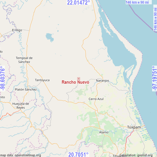
Rancho Nuevo GPS coordinates[2]
21° 21' 40.932" North, 97° 54' 2.268" West
| Map corner | latitude | longitude |
|---|---|---|
| Upper-left | 22.01472°, | -98.60376° |
| Center: | 21.36137°, | -97.90063° |
| Lower-right: | 20.7051°, | -97.19751° |
| Map W x H: | 145.6×145.6 km | = 90.5×90.5mi |
| max Lat: | 32.7° ⇑19.5% North |
| Rancho Nuevo: | 21.36137° |
| min Lat: | ⇓80.5% South 14.53588° |
| min Long | Rancho Nuevo | max Long |
| -117.105° | -97.90063° | -86.73105° |
| W 64.8%⇐ | ⇒35.2% E |
Elevation
Elevation of Rancho Nuevo is 122 m = 400 ft, and this is 1131.7 m = 3713 ft below average elevation for this country.
| Max E: |
3497 m = 11473 ft | 78.4% |
| Avg. | 1253.7 m = 4113 ft | |
| Rancho Nuevo | 122 m = 400 ft | |
Min E: |
-1 m = -3 ft | 21.6% |
See also: Mexico elevation on elevation.city.
Geographical zone
Rancho Nuevo is located in North Torrid zone (between Equator and Tropic of Cancer). Distance of this Northern Tropic circle is 230.8 km =143.4 mi to North.| Distance of | km | miles | from Rancho Nuevo |
|---|---|---|---|
| North Pole | 7631.9 | 4742.2 | to North |
| Arctic Circle | 5026 | 3123 | to North |
| Tropic Cancer | 230.8 | 143.4 | to North |
| Equator | 2375.2 | 1475.9 | to South |


Nearby cities:
15 places around Rancho Nuevo: (largest is in red/bold)
• Amatlán
15.2 km =9.4 mi,  101°
101°
• Carmona y Valle
10.9 km =6.8 mi,  90°
90°
• Chontla
7.7 km =4.8 mi,  198°
198°
• Citlaltépec
4.2 km =2.6 mi,  147°
147°
• Cruz Manantial
8.6 km =5.3 mi,  242°
242°
• El Naranjal
3.2 km =2 mi,  161°
161°
• Gutiérrez Zamora
10.6 km =6.6 mi, 85°
• La Garita
5.5 km =3.4 mi, 200°
• Las Cruces
12.5 km =7.8 mi, 204°
• Las Sabinas
5.2 km =3.2 mi, 156°
• Mata de Otate
8.9 km =5.5 mi,  260°
260°
• San Francisco
9.7 km =6 mi,  213°
213°
• Tamalín
9.5 km =5.9 mi, 104°
• Tancoco
14.1 km =8.8 mi,  126°
126°
• Tantima
7.7 km =4.8 mi,  114°
114°
Sources, notices
• [Note1] Compared only with cities in Mexico existing in our database
• [Src1] Map data: © OpenStreetMap contributors (CC-BY-SA)
• [Src2] Other city data from geonames.org with taken over terms of usage.
• [Src3] Geographical zone / Annual Mean Temperature by Robert A. Rohde @ Wikipedia
