La Trinidad geodata
La Trinidad (Oaxaca) is a populated place; located in Mexico in America/Mexico_City (GMT-6) time zone. With population of 651 people, there are 13306 cities with bigger population in this country. Compared to other cities in Mexico, 83.7% of cities are located further ↑North; 83.1% of cities are located further ←West and 78.5% of cities have higher elevation than La Trinidad. Note1


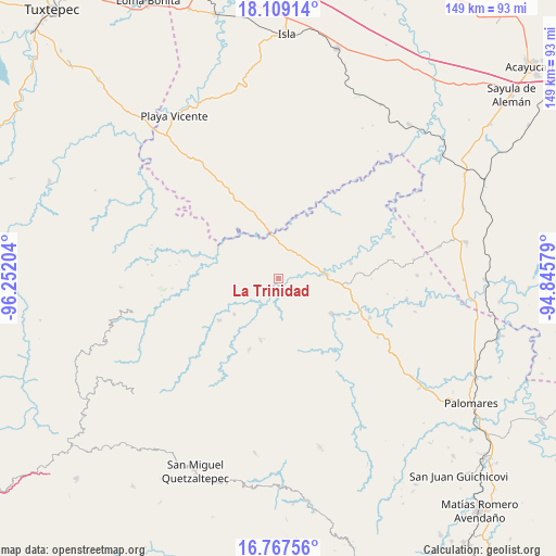
La Trinidad GPS coordinates[2]
17° 26' 22.488" North, 95° 32' 56.076" West
| Map corner | latitude | longitude |
|---|---|---|
| Upper-left | 18.10914°, | -96.25204° |
| Center: | 17.43958°, | -95.54891° |
| Lower-right: | 16.76756°, | -94.84579° |
| Map W x H: | 149.2×149.2 km | = 92.7×92.7mi |
| max Lat: | 32.7° ⇑83.7% North |
| La Trinidad: | 17.43958° |
| min Lat: | ⇓16.3% South 14.53588° |
| min Long | La Trinidad | max Long |
| -117.105° | -95.54891° | -86.73105° |
| W 83.1%⇐ | ⇒16.9% E |
Elevation
Elevation of La Trinidad is 120 m = 394 ft, and this is 1133.7 m = 3719 ft below average elevation for this country.
| Max E: |
3497 m = 11473 ft | 78.5% |
| Avg. | 1253.7 m = 4113 ft | |
| La Trinidad | 120 m = 394 ft | |
Min E: |
-1 m = -3 ft | 21.5% |
See also: Mexico elevation on elevation.city.
Geographical zone
La Trinidad is located in North Torrid zone (between Equator and Tropic of Cancer). Distance of this Northern Tropic circle is 666.8 km =414.3 mi to North.| Distance of | km | miles | from La Trinidad |
|---|---|---|---|
| North Pole | 8068 | 5013.2 | to North |
| Arctic Circle | 5462.1 | 3394 | to North |
| Tropic Cancer | 666.8 | 414.3 | to North |
| Equator | 1939.1 | 1204.9 | to South |


Nearby cities:
15 places around La Trinidad: (largest is in red/bold)
• Arroyo Carrizal
11.8 km =7.3 mi,  85°
85°
• Arroyo Colorado (Cruz Verde)
18.9 km =11.7 mi,  305°
305°
• Dolores Hidalgo
8.5 km =5.3 mi,  52°
52°
• Francisco Villa
10.6 km =6.6 mi,  68°
68°
• Jaltepec de Candayoc
17.1 km =10.6 mi,  123°
123°
• María Lombardo de Caso
12.8 km =8 mi, 85°
• Nuevo San Martín
15.8 km =9.8 mi,  9°
9°
• Paso del Águila
15.2 km =9.4 mi,  321°
321°
• San Felipe Cihualtepec
19.7 km =12.2 mi,  77°
77°
• San José de las Flores
18.8 km =11.7 mi, 121°
• San Juan Jaltepec
15.5 km =9.6 mi,  231°
231°
• San Juan Otzolotepec
17.4 km =10.8 mi,  195°
195°
• Santa María Puxmetacán
20.6 km =12.8 mi, 202°
• Santiago Yaveo
19.8 km =12.3 mi, 233°
• Tatahuicapá
15.8 km =9.8 mi, 321°
Sources, notices
• [Note1] Compared only with cities in Mexico existing in our database
• [Src1] Map data: © OpenStreetMap contributors (CC-BY-SA)
• [Src2] Other city data from geonames.org with taken over terms of usage.
• [Src3] Geographical zone / Annual Mean Temperature by Robert A. Rohde @ Wikipedia
