La Soledad geodata
La Soledad (Oaxaca) is a populated place; located in Mexico in America/Mexico_City (GMT-6) time zone. With population of 519 people, there are 16226 cities with bigger population in this country. Compared to other cities in Mexico, 94.9% of cities are located further ↑North; 79% of cities are located further ←West and 57.6% of cities have lower elevation than La Soledad. Note1


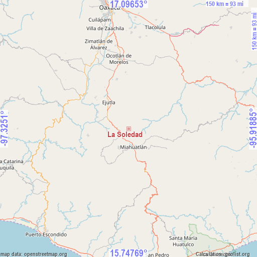
La Soledad GPS coordinates[2]
16° 25' 23.808" North, 96° 37' 19.092" West
| Map corner | latitude | longitude |
|---|---|---|
| Upper-left | 17.09653°, | -97.3251° |
| Center: | 16.42328°, | -96.62197° |
| Lower-right: | 15.74769°, | -95.91885° |
| Map W x H: | 150×150 km | = 93.2×93.2mi |
| max Lat: | 32.7° ⇑94.9% North |
| La Soledad: | 16.42328° |
| min Lat: | ⇓5.1% South 14.53588° |
| min Long | La Soledad | max Long |
| -117.105° | -96.62197° | -86.73105° |
| W 79%⇐ | ⇒21% E |
Elevation
Elevation of La Soledad is 1680 m = 5512 ft, and this is 426.3 m = 1399 ft above average elevation for this country.
| Max E: |
3497 m = 11473 ft | 42.4% |
| La Soledad | 1680 m 5512 ft | |
| Avg. | 1253.7 m = 4113 ft | |
Min E: |
-1 m = -3 ft | 57.6% |
See also: Mexico elevation on elevation.city.
Geographical zone
La Soledad is located in North Torrid zone (between Equator and Tropic of Cancer). Distance of this Northern Tropic circle is 779.8 km =484.5 mi to North.| Distance of | km | miles | from La Soledad |
|---|---|---|---|
| North Pole | 8181 | 5083.4 | to North |
| Arctic Circle | 5575.1 | 3464.2 | to North |
| Tropic Cancer | 779.8 | 484.5 | to North |
| Equator | 1826.1 | 1134.7 | to South |


Nearby cities:
15 places around La Soledad: (largest is in red/bold)
• Agua del Sol
12.8 km =8 mi,  294°
294°
• El Zompantle
5.5 km =3.4 mi, 293°
• Guixé
10.1 km =6.3 mi,  301°
301°
• La Escalera
5.4 km =3.4 mi,  19°
19°
• Miahuatlán de Porfirio Díaz
10.5 km =6.5 mi,  164°
164°
• Monjas
6.3 km =3.9 mi,  199°
199°
• San Esteban Amatlán
11.8 km =7.3 mi,  40°
40°
• San Luis Amatlán
13.8 km =8.6 mi,  107°
107°
• San Nicolás
12.7 km =7.9 mi,  268°
268°
• San Simón Almolongas
10.5 km =6.5 mi,  259°
259°
• Santa Ana
13.6 km =8.5 mi,  228°
228°
• Santa Catarina Cuixtla
13.2 km =8.2 mi,  189°
189°
• Santa Cruz Xitla
12.4 km =7.7 mi,  206°
206°
• Santa María Velato
9.3 km =5.8 mi,  344°
344°
• Sitio de Xitlapehua
12.5 km =7.8 mi,  129°
129°
Sources, notices
• [Note1] Compared only with cities in Mexico existing in our database
• [Src1] Map data: © OpenStreetMap contributors (CC-BY-SA)
• [Src2] Other city data from geonames.org with taken over terms of usage.
• [Src3] Geographical zone / Annual Mean Temperature by Robert A. Rohde @ Wikipedia
