Santa Cruz Xitla geodata
Santa Cruz Xitla (Oaxaca) is a seat of a second-order administrative division; located in Mexico in America/Mexico_City (GMT-6) time zone. With population of 3,857 people, there are 2375 cities with bigger population in this country. Compared to other cities in Mexico, 95.5% of cities are located further ↑North; 78.6% of cities are located further ←West and 63.6% of cities have lower elevation than Santa Cruz Xitla. Note1


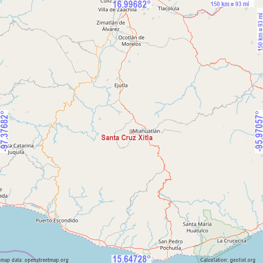
Santa Cruz Xitla GPS coordinates[2]
16° 19' 23.556" North, 96° 40' 25.284" West
| Map corner | latitude | longitude |
|---|---|---|
| Upper-left | 16.99682°, | -97.37682° |
| Center: | 16.32321°, | -96.67369° |
| Lower-right: | 15.64728°, | -95.97057° |
| Map W x H: | 150.1×150.1 km | = 93.3×93.3mi |
| max Lat: | 32.7° ⇑95.5% North |
| Santa Cruz Xitla: | 16.32321° |
| min Lat: | ⇓4.5% South 14.53588° |
| min Long | Santa Cruz Xitl | max Long |
| -117.105° | -96.67369° | -86.73105° |
| W 78.6%⇐ | ⇒21.4% E |
Elevation
Elevation of Santa Cruz Xitla is 1791 m = 5876 ft, and this is 537.3 m = 1763 ft above average elevation for this country.
| Max E: |
3497 m = 11473 ft | 36.4% |
| Santa Cruz Xitla | 1791 m 5876 ft | |
| Avg. | 1253.7 m = 4113 ft | |
Min E: |
-1 m = -3 ft | 63.6% |
See also: Mexico elevation on elevation.city.
Geographical zone
Santa Cruz Xitla is located in North Torrid zone (between Equator and Tropic of Cancer). Distance of this Northern Tropic circle is 790.9 km =491.4 mi to North.| Distance of | km | miles | from Santa Cruz Xitla |
|---|---|---|---|
| North Pole | 8192.1 | 5090.3 | to North |
| Arctic Circle | 5586.2 | 3471.1 | to North |
| Tropic Cancer | 790.9 | 491.4 | to North |
| Equator | 1815 | 1127.8 | to South |


Nearby cities:
15 places around Santa Cruz Xitla: (largest is in red/bold)
• El Zompantle
13.3 km =8.3 mi,  1°
1°
• La Soledad
12.4 km =7.7 mi,  26°
26°
• Miahuatlán de Porfirio Díaz
8.4 km =5.2 mi,  82°
82°
• Monjas
6.2 km =3.9 mi, 33°
• San Miguel Coatlán
14.2 km =8.8 mi,  189°
189°
• San Miguel Yogovana
6.8 km =4.2 mi,  137°
137°
• San Nicolás
13 km =8.1 mi,  326°
326°
• San Pablo Coatlán
16.1 km =10 mi,  226°
226°
• San Pedro Coatlán
10.8 km =6.7 mi,  224°
224°
• San Simón Almolongas
10.5 km =6.5 mi, 332°
• Santa Ana
5 km =3.1 mi,  293°
293°
• Santa Catarina Coatlán
11.1 km =6.9 mi,  255°
255°
• Santa Catarina Cuixtla
3.8 km =2.4 mi,  119°
119°
• Santo Tomás Tamazulapam
11.4 km =7.1 mi, 120°
• Sitio de Xitlapehua
15.4 km =9.6 mi, 78°
Sources, notices
• [Note1] Compared only with cities in Mexico existing in our database
• [Src1] Map data: © OpenStreetMap contributors (CC-BY-SA)
• [Src2] Other city data from geonames.org with taken over terms of usage.
• [Src3] Geographical zone / Annual Mean Temperature by Robert A. Rohde @ Wikipedia
