Lachixova geodata
Lachixova (Oaxaca) is a populated place; located in Mexico in America/Mexico_City (GMT-6) time zone. With population of 703 people, there are 12379 cities with bigger population in this country. Compared to other cities in Mexico, 85.1% of cities are located further ↑North; 82.3% of cities are located further ←West and 54.8% of cities have higher elevation than Lachixova. Note1


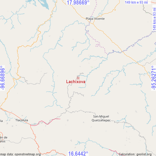
Lachixova GPS coordinates[2]
17° 19' 0.012" North, 95° 57' 56.988" West
| Map corner | latitude | longitude |
|---|---|---|
| Upper-left | 17.98669°, | -96.66896° |
| Center: | 17.31667°, | -95.96583° |
| Lower-right: | 16.6442°, | -95.26271° |
| Map W x H: | 149.3×149.3 km | = 92.8×92.8mi |
| max Lat: | 32.7° ⇑85.1% North |
| Lachixova: | 17.31667° |
| min Lat: | ⇓14.9% South 14.53588° |
| min Long | Lachixova | max Long |
| -117.105° | -95.96583° | -86.73105° |
| W 82.3%⇐ | ⇒17.7% E |
Elevation
Elevation of Lachixova is 1205 m = 3953 ft, and this is 48.7 m = 160 ft below average elevation for this country.
| Max E: |
3497 m = 11473 ft | 54.8% |
| Avg. | 1253.7 m = 4113 ft | |
| Lachixova | 1205 m = 3953 ft | |
Min E: |
-1 m = -3 ft | 45.2% |
See also: Mexico elevation on elevation.city.
Geographical zone
Lachixova is located in North Torrid zone (between Equator and Tropic of Cancer). Distance of this Northern Tropic circle is 680.5 km =422.8 mi to North.| Distance of | km | miles | from Lachixova |
|---|---|---|---|
| North Pole | 8081.6 | 5021.7 | to North |
| Arctic Circle | 5475.7 | 3402.4 | to North |
| Tropic Cancer | 680.5 | 422.8 | to North |
| Equator | 1925.4 | 1196.4 | to South |


Nearby cities:
15 places around Lachixova: (largest is in red/bold)
• Chinantequilla
3.5 km =2.2 mi,  255°
255°
• La Candelaria
11.5 km =7.1 mi,  162°
162°
• San Andrés Yaá
20.1 km =12.5 mi, 262°
• San Francisco Jayacaxtepec
10.6 km =6.6 mi,  185°
185°
• San Ildefonso Villa Alta
19.9 km =12.4 mi,  276°
276°
• San Juan Metaltepec
16.7 km =10.4 mi, 159°
• San Juan Petlapa
18.5 km =11.5 mi,  336°
336°
• San Juan Yalahui
20.8 km =12.9 mi,  298°
298°
• Santa María Tiltepec
16.7 km =10.4 mi,  236°
236°
• Santiago Choápam
6.8 km =4.2 mi,  43°
43°
• Santiago Tepitongo
7.2 km =4.5 mi, 256°
• Santiago Zacatepec
18.2 km =11.3 mi, 162°
• Santo Domingo Latani
9.2 km =5.7 mi,  48°
48°
• Santo Domingo Roayaga
16 km =9.9 mi, 278°
• Totontepec Villa de Morelos
9.4 km =5.8 mi,  224°
224°
Sources, notices
• [Note1] Compared only with cities in Mexico existing in our database
• [Src1] Map data: © OpenStreetMap contributors (CC-BY-SA)
• [Src2] Other city data from geonames.org with taken over terms of usage.
• [Src3] Geographical zone / Annual Mean Temperature by Robert A. Rohde @ Wikipedia
