Jalapa geodata
Jalapa (Oaxaca) is a populated place; located in Mexico in America/Mexico_City (GMT-6) time zone. With population of 8,289 people, there are 1147 cities with bigger population in this country. Compared to other cities in Mexico, 94.3% of cities are located further ↑North; 83.2% of cities are located further ←West and 78.2% of cities have higher elevation than Jalapa. Note1


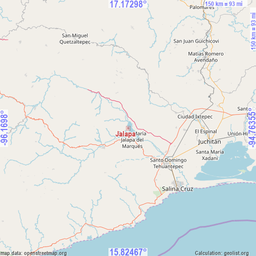
Jalapa GPS coordinates[2]
16° 30' 0" North, 95° 28' 0.012" West
| Map corner | latitude | longitude |
|---|---|---|
| Upper-left | 17.17298°, | -96.1698° |
| Center: | 16.5°, | -95.46667° |
| Lower-right: | 15.82467°, | -94.76355° |
| Map W x H: | 149.9×149.9 km | = 93.1×93.1mi |
| max Lat: | 32.7° ⇑94.3% North |
| Jalapa: | 16.5° |
| min Lat: | ⇓5.7% South 14.53588° |
| min Long | Jalapa | max Long |
| -117.105° | -95.46667° | -86.73105° |
| W 83.2%⇐ | ⇒16.8% E |
Elevation
Elevation of Jalapa is 126 m = 413 ft, and this is 1127.7 m = 3700 ft below average elevation for this country.
| Max E: |
3497 m = 11473 ft | 78.2% |
| Avg. | 1253.7 m = 4113 ft | |
| Jalapa | 126 m = 413 ft | |
Min E: |
-1 m = -3 ft | 21.8% |
See also: Mexico elevation on elevation.city.
Geographical zone
Jalapa is located in North Torrid zone (between Equator and Tropic of Cancer). Distance of this Northern Tropic circle is 771.3 km =479.3 mi to North.| Distance of | km | miles | from Jalapa |
|---|---|---|---|
| North Pole | 8172.4 | 5078.1 | to North |
| Arctic Circle | 5566.5 | 3458.9 | to North |
| Tropic Cancer | 771.3 | 479.3 | to North |
| Equator | 1834.6 | 1140 | to South |


Nearby cities:
15 places around Jalapa: (largest is in red/bold)
• Colonia Jordán
30.8 km =19.1 mi,  113°
113°
• Colonia San Luis
27.5 km =17.1 mi,  119°
119°
• Guadalupe Guevea
28 km =17.4 mi,  343°
343°
• Magdalena Tequisistlán
18.3 km =11.4 mi,  232°
232°
• Magdalena Tlacotepec
28.2 km =17.5 mi,  89°
89°
• San Blas Atempa
31.8 km =19.8 mi,  126°
126°
• San Cristóbal
9.3 km =5.8 mi, 228°
• San Miguel Tenango
29.4 km =18.3 mi,  207°
207°
• Santa María Guenagati
29.1 km =18.1 mi,  24°
24°
• Santa María Jalapa del Marqués
7 km =4.3 mi,  160°
160°
• Santa María Mixtequilla
26 km =16.2 mi, 122°
• Santa María Totolapilla
20.3 km =12.6 mi,  303°
303°
• Santiago Lachiguiri
21.9 km =13.6 mi, 341°
• Santiago Laollaga
29.2 km =18.1 mi,  71°
71°
• Santo Domingo Tehuantepec
31 km =19.3 mi, 129°
Sources, notices
• [Note1] Compared only with cities in Mexico existing in our database
• [Src1] Map data: © OpenStreetMap contributors (CC-BY-SA)
• [Src2] Other city data from geonames.org with taken over terms of usage.
• [Src3] Geographical zone / Annual Mean Temperature by Robert A. Rohde @ Wikipedia
