Ixcatepec geodata
Ixcatepec (Veracruz) is a populated place; located in Mexico in America/Mexico_City (GMT-6) time zone. With population of 3,975 people, there are 2291 cities with bigger population in this country. Compared to other cities in Mexico, 79.5% of cities are located further ↓South; 63.5% of cities are located further ←West and 75.4% of cities have higher elevation than Ixcatepec. Note1


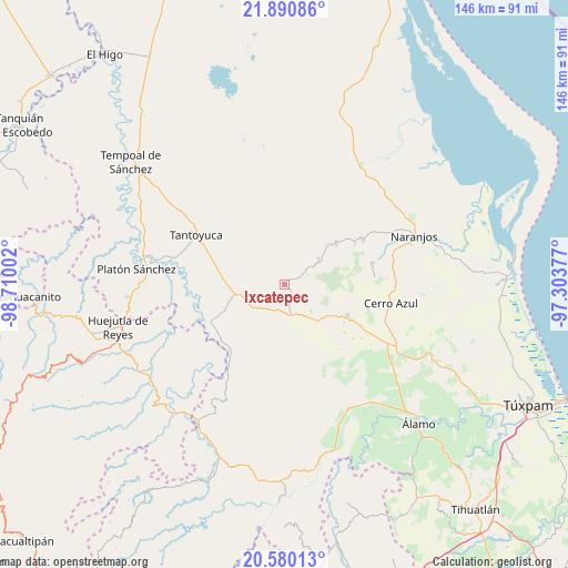
Ixcatepec GPS coordinates[2]
21° 14' 13.02" North, 98° 0' 24.804" West
| Map corner | latitude | longitude |
|---|---|---|
| Upper-left | 21.89086°, | -98.71002° |
| Center: | 21.23695°, | -98.00689° |
| Lower-right: | 20.58013°, | -97.30377° |
| Map W x H: | 145.7×145.7 km | = 90.5×90.5mi |
| max Lat: | 32.7° ⇑20.5% North |
| Ixcatepec: | 21.23695° |
| min Lat: | ⇓79.5% South 14.53588° |
| min Long | Ixcatepec | max Long |
| -117.105° | -98.00689° | -86.73105° |
| W 63.5%⇐ | ⇒36.5% E |
Elevation
Elevation of Ixcatepec is 208 m = 682 ft, and this is 1045.7 m = 3431 ft below average elevation for this country.
| Max E: |
3497 m = 11473 ft | 75.4% |
| Avg. | 1253.7 m = 4113 ft | |
| Ixcatepec | 208 m = 682 ft | |
Min E: |
-1 m = -3 ft | 24.6% |
See also: Mexico elevation on elevation.city.
Geographical zone
Ixcatepec is located in North Torrid zone (between Equator and Tropic of Cancer). Distance of this Northern Tropic circle is 244.6 km =152 mi to North.| Distance of | km | miles | from Ixcatepec |
|---|---|---|---|
| North Pole | 7645.7 | 4750.8 | to North |
| Arctic Circle | 5039.8 | 3131.6 | to North |
| Tropic Cancer | 244.6 | 152 | to North |
| Equator | 2361.3 | 1467.2 | to South |


Nearby cities:
15 places around Ixcatepec: (largest is in red/bold)
• Callejón Santa Clara
13.5 km =8.4 mi,  288°
288°
• Chontla
10.8 km =6.7 mi,  52°
52°
• Copaltitla
14.9 km =9.3 mi,  112°
112°
• Cruz Manantial
10.4 km =6.5 mi,  18°
18°
• El Gavilán
2.9 km =1.8 mi,  182°
182°
• El Humo
9.6 km =6 mi,  135°
135°
• El Rincón
10.3 km =6.4 mi,  331°
331°
• Francia Nueva
14.5 km =9 mi,  157°
157°
• La Garita
12.6 km =7.8 mi, 46°
• Las Cruces
6.4 km =4 mi,  67°
67°
• Los Ajos
15.1 km =9.4 mi,  251°
251°
• Mata de Otate
12.5 km =7.8 mi,  10°
10°
• San Francisco
8 km =5 mi,  44°
44°
• San Sebastián
13.2 km =8.2 mi,  260°
260°
• Tierra Blanca
12.5 km =7.8 mi,  133°
133°
Sources, notices
• [Note1] Compared only with cities in Mexico existing in our database
• [Src1] Map data: © OpenStreetMap contributors (CC-BY-SA)
• [Src2] Other city data from geonames.org with taken over terms of usage.
• [Src3] Geographical zone / Annual Mean Temperature by Robert A. Rohde @ Wikipedia
