Cruz Manantial geodata
Cruz Manantial (Veracruz) is a populated place; located in Mexico in America/Mexico_City (GMT-6) time zone. With population of 600 people, there are 14337 cities with bigger population in this country. Compared to other cities in Mexico, 80.2% of cities are located further ↓South; 63.9% of cities are located further ←West and 79.2% of cities have higher elevation than Cruz Manantial. Note1


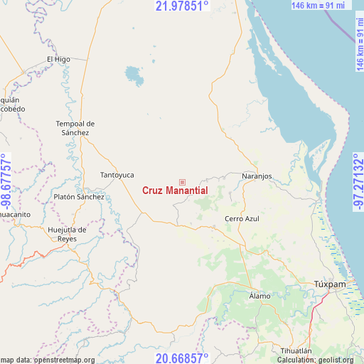
Cruz Manantial GPS coordinates[2]
21° 19' 30" North, 97° 58' 27.984" West
| Map corner | latitude | longitude |
|---|---|---|
| Upper-left | 21.97851°, | -98.67757° |
| Center: | 21.325°, | -97.97444° |
| Lower-right: | 20.66857°, | -97.27132° |
| Map W x H: | 145.7×145.7 km | = 90.5×90.5mi |
| max Lat: | 32.7° ⇑19.8% North |
| Cruz Manantial: | 21.325° |
| min Lat: | ⇓80.2% South 14.53588° |
| min Long | Cruz Manantial | max Long |
| -117.105° | -97.97444° | -86.73105° |
| W 63.9%⇐ | ⇒36.1% E |
Elevation
Elevation of Cruz Manantial is 108 m = 354 ft, and this is 1145.7 m = 3759 ft below average elevation for this country.
| Max E: |
3497 m = 11473 ft | 79.2% |
| Avg. | 1253.7 m = 4113 ft | |
| Cruz Manantial | 108 m = 354 ft | |
Min E: |
-1 m = -3 ft | 20.8% |
See also: Mexico elevation on elevation.city.
Geographical zone
Cruz Manantial is located in North Torrid zone (between Equator and Tropic of Cancer). Distance of this Northern Tropic circle is 234.8 km =145.9 mi to North.| Distance of | km | miles | from Cruz Manantial |
|---|---|---|---|
| North Pole | 7635.9 | 4744.7 | to North |
| Arctic Circle | 5030.1 | 3125.6 | to North |
| Tropic Cancer | 234.8 | 145.9 | to North |
| Equator | 2371.1 | 1473.3 | to South |


Nearby cities:
15 places around Cruz Manantial: (largest is in red/bold)
• Chontla
6.1 km =3.8 mi,  121°
121°
• Citlaltépec
9.9 km =6.2 mi,  87°
87°
• El Gavilán
13.2 km =8.2 mi,  195°
195°
• El Humo
16.9 km =10.5 mi,  168°
168°
• El Naranjal
8.7 km =5.4 mi,  83°
83°
• El Rincón
8.4 km =5.2 mi,  264°
264°
• Ixcatepec
10.4 km =6.5 mi, 198°
• La Garita
5.8 km =3.6 mi,  100°
100°
• Las Cruces
7.8 km =4.8 mi,  161°
161°
• Las Sabinas
9.7 km =6 mi, 94°
• Mata de Otate
2.8 km =1.7 mi,  335°
335°
• Rancho Nuevo
8.6 km =5.3 mi,  62°
62°
• San Francisco
4.6 km =2.9 mi,  151°
151°
• Tamalín
16.9 km =10.5 mi, 84°
• Tantima
14.6 km =9.1 mi, 86°
Sources, notices
• [Note1] Compared only with cities in Mexico existing in our database
• [Src1] Map data: © OpenStreetMap contributors (CC-BY-SA)
• [Src2] Other city data from geonames.org with taken over terms of usage.
• [Src3] Geographical zone / Annual Mean Temperature by Robert A. Rohde @ Wikipedia
