Guadalupe Hidalgo geodata
Guadalupe Hidalgo (Oaxaca) is a populated place; located in Mexico in America/Mexico_City (GMT-6) time zone. With population of 1,228 people, there are 7063 cities with bigger population in this country. Compared to other cities in Mexico, 87.1% of cities are located further ↑North; 77.1% of cities are located further ←West and 55.5% of cities have lower elevation than Guadalupe Hidalgo. Note1


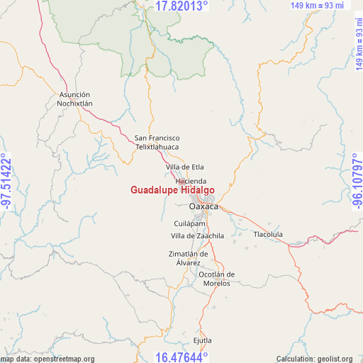
Guadalupe Hidalgo GPS coordinates[2]
17° 8' 58.2" North, 96° 48' 39.924" West
| Map corner | latitude | longitude |
|---|---|---|
| Upper-left | 17.82013°, | -97.51422° |
| Center: | 17.1495°, | -96.81109° |
| Lower-right: | 16.47644°, | -96.10797° |
| Map W x H: | 149.4×149.4 km | = 92.8×92.8mi |
| max Lat: | 32.7° ⇑87.1% North |
| Guadalupe Hidalgo: | 17.1495° |
| min Lat: | ⇓12.9% South 14.53588° |
| min Long | Guadalupe Hidal | max Long |
| -117.105° | -96.81109° | -86.73105° |
| W 77.1%⇐ | ⇒22.9% E |
Elevation
Elevation of Guadalupe Hidalgo is 1603 m = 5259 ft, and this is 349.3 m = 1146 ft above average elevation for this country.
| Max E: |
3497 m = 11473 ft | 44.5% |
| Guadalupe Hidalgo | 1603 m 5259 ft | |
| Avg. | 1253.7 m = 4113 ft | |
Min E: |
-1 m = -3 ft | 55.5% |
See also: Mexico elevation on elevation.city.
Geographical zone
Guadalupe Hidalgo is located in North Torrid zone (between Equator and Tropic of Cancer). Distance of this Northern Tropic circle is 699.1 km =434.4 mi to North.| Distance of | km | miles | from Guadalupe Hidalgo |
|---|---|---|---|
| North Pole | 8100.2 | 5033.2 | to North |
| Arctic Circle | 5494.3 | 3414 | to North |
| Tropic Cancer | 699.1 | 434.4 | to North |
| Equator | 1906.8 | 1184.8 | to South |


Nearby cities:
15 places around Guadalupe Hidalgo: (largest is in red/bold)
• Alemán
5.6 km =3.5 mi,  329°
329°
• Barrio Morelos
4.2 km =2.6 mi,  106°
106°
• Fraccionamiento Real Santa María
4 km =2.5 mi,  150°
150°
• Fraccionamiento Riberas de San Jerónimo
5.5 km =3.4 mi,  138°
138°
• Guadalupe Etla
2.6 km =1.6 mi,  2°
2°
• Hacienda Blanca
3.9 km =2.4 mi, 105°
• Matadamas
1.3 km =0.8 mi, 331°
• Poblado Morelos
3.8 km =2.4 mi,  86°
86°
• Reyes Etla
5.9 km =3.7 mi,  352°
352°
• San Felipe Tejalápam
6.2 km =3.9 mi,  227°
227°
• San Isidro
5.3 km =3.3 mi,  339°
339°
• San Lorenzo Cacaotepec
2.6 km =1.6 mi,  159°
159°
• San Sebastián Etla
3.4 km =2.1 mi,  60°
60°
• Santiago Etla
2.3 km =1.4 mi,  81°
81°
• Santo Domingo Barrio Alto
5.8 km =3.6 mi,  23°
23°
Sources, notices
• [Note1] Compared only with cities in Mexico existing in our database
• [Src1] Map data: © OpenStreetMap contributors (CC-BY-SA)
• [Src2] Other city data from geonames.org with taken over terms of usage.
• [Src3] Geographical zone / Annual Mean Temperature by Robert A. Rohde @ Wikipedia
