El Zapote geodata
El Zapote (Veracruz) is a populated place; located in Mexico in America/Mexico_City (GMT-6) time zone. With population of 895 people, there are 9743 cities with bigger population in this country. Compared to other cities in Mexico, 69.8% of cities are located further ↑North; 82.3% of cities are located further ←West and 97% of cities have higher elevation than El Zapote. Note1


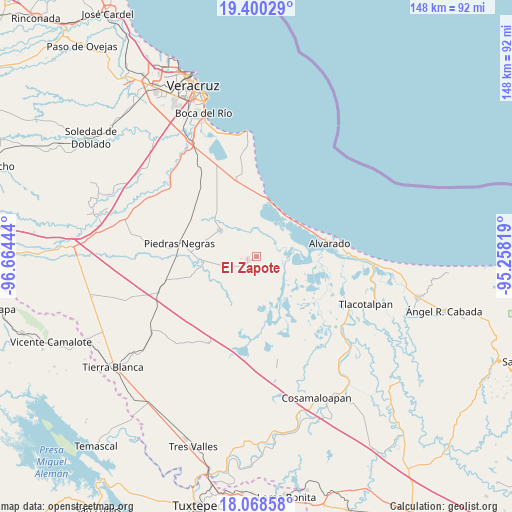
El Zapote GPS coordinates[2]
18° 44' 8.7" North, 95° 57' 40.716" West
| Map corner | latitude | longitude |
|---|---|---|
| Upper-left | 19.40029°, | -96.66444° |
| Center: | 18.73575°, | -95.96131° |
| Lower-right: | 18.06858°, | -95.25819° |
| Map W x H: | 148.1×148.1 km | = 92×92mi |
| max Lat: | 32.7° ⇑69.8% North |
| El Zapote: | 18.73575° |
| min Lat: | ⇓30.2% South 14.53588° |
| min Long | El Zapote | max Long |
| -117.105° | -95.96131° | -86.73105° |
| W 82.3%⇐ | ⇒17.7% E |
Elevation
Elevation of El Zapote is 10 m = 33 ft, and this is 1243.7 m = 4080 ft below average elevation for this country.
| Max E: |
3497 m = 11473 ft | 97% |
| Avg. | 1253.7 m = 4113 ft | |
| El Zapote | 10 m = 33 ft | |
Min E: |
-1 m = -3 ft | 3% |
See also: Mexico elevation on elevation.city.
Geographical zone
El Zapote is located in North Torrid zone (between Equator and Tropic of Cancer). Distance of this Northern Tropic circle is 522.7 km =324.8 mi to North.| Distance of | km | miles | from El Zapote |
|---|---|---|---|
| North Pole | 7923.8 | 4923.6 | to North |
| Arctic Circle | 5318 | 3304.5 | to North |
| Tropic Cancer | 522.7 | 324.8 | to North |
| Equator | 2083.2 | 1294.4 | to South |


Nearby cities:
15 places around El Zapote: (largest is in red/bold)
• Arbolillo
15.9 km =9.9 mi,  55°
55°
• El Cocuite
13.1 km =8.1 mi,  261°
261°
• El Ojochal
9.2 km =5.7 mi,  252°
252°
• El Salitral
9.4 km =5.8 mi,  200°
200°
• El Salto
12.4 km =7.7 mi,  221°
221°
• El Sauce (Cerro Grande)
11.5 km =7.1 mi, 256°
• Ignacio de la Llave
2.9 km =1.8 mi, 247°
• Moyotla
5.8 km =3.6 mi, 254°
• Palma Cuata
7.7 km =4.8 mi,  230°
230°
• Pozuelo
15.8 km =9.8 mi,  310°
310°
• Tlalixcoyan
12.8 km =8 mi, 305°
• Tuzales
15.3 km =9.5 mi,  289°
289°
• Villanueva
5.7 km =3.5 mi,  210°
210°
• Zacate Colorado Primero (El Moral)
8.2 km =5.1 mi, 203°
• Zacate Colorado Segundo (Fraternidad)
5.9 km =3.7 mi,  190°
190°
Sources, notices
• [Note1] Compared only with cities in Mexico existing in our database
• [Src1] Map data: © OpenStreetMap contributors (CC-BY-SA)
• [Src2] Other city data from geonames.org with taken over terms of usage.
• [Src3] Geographical zone / Annual Mean Temperature by Robert A. Rohde @ Wikipedia
