El Corte geodata
El Corte (Veracruz) is a populated place; located in Mexico in America/Mexico_City (GMT-6) time zone. With population of 2,126 people, there are 4118 cities with bigger population in this country. Compared to other cities in Mexico, 73.1% of cities are located further ↑North; 82.8% of cities are located further ←West and 95.7% of cities have higher elevation than El Corte. Note1


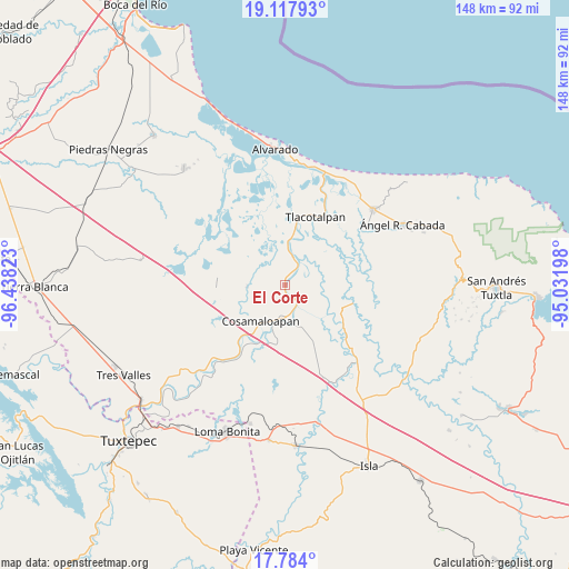
El Corte GPS coordinates[2]
18° 27' 8.136" North, 95° 44' 6.36" West
| Map corner | latitude | longitude |
|---|---|---|
| Upper-left | 19.11793°, | -96.43823° |
| Center: | 18.45226°, | -95.7351° |
| Lower-right: | 17.784°, | -95.03198° |
| Map W x H: | 148.3×148.3 km | = 92.1×92.1mi |
| max Lat: | 32.7° ⇑73.1% North |
| El Corte: | 18.45226° |
| min Lat: | ⇓26.9% South 14.53588° |
| min Long | El Corte | max Long |
| -117.105° | -95.7351° | -86.73105° |
| W 82.8%⇐ | ⇒17.2% E |
Elevation
Elevation of El Corte is 12 m = 39 ft, and this is 1241.7 m = 4074 ft below average elevation for this country.
| Max E: |
3497 m = 11473 ft | 95.7% |
| Avg. | 1253.7 m = 4113 ft | |
| El Corte | 12 m = 39 ft | |
Min E: |
-1 m = -3 ft | 4.3% |
See also: Mexico elevation on elevation.city.
Geographical zone
El Corte is located in North Torrid zone (between Equator and Tropic of Cancer). Distance of this Northern Tropic circle is 554.2 km =344.4 mi to North.| Distance of | km | miles | from El Corte |
|---|---|---|---|
| North Pole | 7955.4 | 4943.3 | to North |
| Arctic Circle | 5349.5 | 3324 | to North |
| Tropic Cancer | 554.2 | 344.4 | to North |
| Equator | 2051.7 | 1274.9 | to South |


Nearby cities:
15 places around El Corte: (largest is in red/bold)
• Acula
7.2 km =4.5 mi,  325°
325°
• Amatitlán
2.3 km =1.4 mi,  174°
174°
• Arroyo del Soldado (Arroyo del Obispo)
15.8 km =9.8 mi,  196°
196°
• Carlos A. Carrillo
8.9 km =5.5 mi,  193°
193°
• Chicalpextle
12.3 km =7.6 mi,  235°
235°
• Cosamaloapan
11.6 km =7.2 mi,  215°
215°
• Dos Bocas
5.5 km =3.4 mi,  147°
147°
• El Mirador
19.2 km =11.9 mi, 241°
• Mozapa
13.2 km =8.2 mi, 244°
• Pachuca
12.8 km =8 mi,  250°
250°
• San Francisco (Oyozontle)
18 km =11.2 mi, 220°
• Santiago
10.1 km =6.3 mi,  267°
267°
• Tilapa
15.6 km =9.7 mi, 189°
• Tlacotalpan
19.6 km =12.2 mi,  24°
24°
• Venustiano Carranza
7.3 km =4.5 mi, 167°
Sources, notices
• [Note1] Compared only with cities in Mexico existing in our database
• [Src1] Map data: © OpenStreetMap contributors (CC-BY-SA)
• [Src2] Other city data from geonames.org with taken over terms of usage.
• [Src3] Geographical zone / Annual Mean Temperature by Robert A. Rohde @ Wikipedia
