Ejutla de Crespo geodata
Ejutla de Crespo (Oaxaca) is a seat of a second-order administrative division; located in Mexico in America/Mexico_City (GMT-6) time zone. With population of 9,748 people, there are 982 cities with bigger population in this country. Compared to other cities in Mexico, 93.9% of cities are located further ↑North; 78.1% of cities are located further ←West and 50.3% of cities have lower elevation than Ejutla de Crespo. Note1


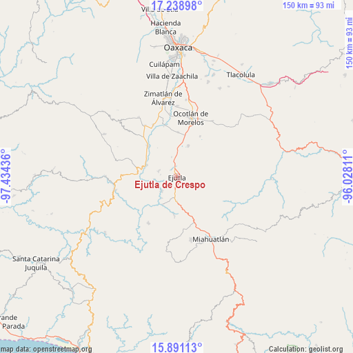
Ejutla de Crespo GPS coordinates[2]
16° 33' 58.428" North, 96° 43' 52.428" West
| Map corner | latitude | longitude |
|---|---|---|
| Upper-left | 17.23898°, | -97.43436° |
| Center: | 16.56623°, | -96.73123° |
| Lower-right: | 15.89113°, | -96.02811° |
| Map W x H: | 149.9×149.9 km | = 93.1×93.1mi |
| max Lat: | 32.7° ⇑93.9% North |
| Ejutla de Crespo: | 16.56623° |
| min Lat: | ⇓6.1% South 14.53588° |
| min Long | Ejutla de Cresp | max Long |
| -117.105° | -96.73123° | -86.73105° |
| W 78.1%⇐ | ⇒21.9% E |
Elevation
Elevation of Ejutla de Crespo is 1448 m = 4751 ft, and this is 194.3 m = 637 ft above average elevation for this country.
| Max E: |
3497 m = 11473 ft | 49.7% |
| Ejutla de Crespo | 1448 m 4751 ft | |
| Avg. | 1253.7 m = 4113 ft | |
Min E: |
-1 m = -3 ft | 50.3% |
See also: Mexico elevation on elevation.city.
Geographical zone
Ejutla de Crespo is located in North Torrid zone (between Equator and Tropic of Cancer). Distance of this Northern Tropic circle is 763.9 km =474.7 mi to North.| Distance of | km | miles | from Ejutla de Crespo |
|---|---|---|---|
| North Pole | 8165.1 | 5073.6 | to North |
| Arctic Circle | 5559.2 | 3454.3 | to North |
| Tropic Cancer | 763.9 | 474.7 | to North |
| Equator | 1842 | 1144.6 | to South |


Nearby cities:
15 places around Ejutla de Crespo: (largest is in red/bold)
• Agua del Espino
8 km =5 mi,  290°
290°
• Agua del Sol
10.5 km =6.5 mi,  180°
180°
• Barranca Larga
8.1 km =5 mi, 180°
• Coatecas Altas
7.3 km =4.5 mi,  114°
114°
• El Cerro de las Huertas
3.2 km =2 mi,  90°
90°
• El Vergel
8.6 km =5.3 mi,  345°
345°
• Hacienda Vieja
4.1 km =2.5 mi,  224°
224°
• La Compañía
9.5 km =5.9 mi,  264°
264°
• La Pe
10 km =6.2 mi,  315°
315°
• Los Ocotes
5.5 km =3.4 mi,  12°
12°
• San Agustín Amatengo
8.7 km =5.4 mi,  225°
225°
• San Martín de los Canseco
10 km =6.2 mi,  2°
2°
• San Miguel Ejutla
1.8 km =1.1 mi,  332°
332°
• Santa Martha Chichihualtepec
10.3 km =6.4 mi, 333°
• Taniche
2.6 km =1.6 mi,  275°
275°
Sources, notices
• [Note1] Compared only with cities in Mexico existing in our database
• [Src1] Map data: © OpenStreetMap contributors (CC-BY-SA)
• [Src2] Other city data from geonames.org with taken over terms of usage.
• [Src3] Geographical zone / Annual Mean Temperature by Robert A. Rohde @ Wikipedia
