El Vergel geodata
El Vergel (Oaxaca) is a populated place; located in Mexico in America/Mexico_City (GMT-6) time zone. With population of 720 people, there are 12117 cities with bigger population in this country. Compared to other cities in Mexico, 93.3% of cities are located further ↑North; 77.9% of cities are located further ←West and 51.1% of cities have lower elevation than El Vergel. Note1


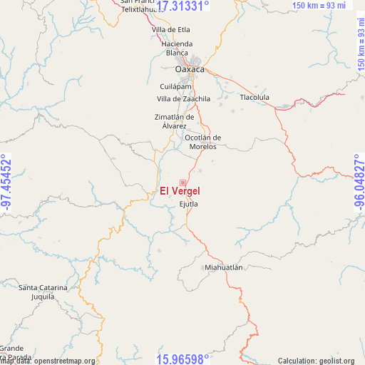
El Vergel GPS coordinates[2]
16° 38' 26.988" North, 96° 45' 5.004" West
| Map corner | latitude | longitude |
|---|---|---|
| Upper-left | 17.31331°, | -97.45452° |
| Center: | 16.64083°, | -96.75139° |
| Lower-right: | 15.96598°, | -96.04827° |
| Map W x H: | 149.8×149.8 km | = 93.1×93.1mi |
| max Lat: | 32.7° ⇑93.3% North |
| El Vergel: | 16.64083° |
| min Lat: | ⇓6.7% South 14.53588° |
| min Long | El Vergel | max Long |
| -117.105° | -96.75139° | -86.73105° |
| W 77.9%⇐ | ⇒22.1% E |
Elevation
Elevation of El Vergel is 1490 m = 4888 ft, and this is 236.3 m = 775 ft above average elevation for this country.
| Max E: |
3497 m = 11473 ft | 48.9% |
| El Vergel | 1490 m 4888 ft | |
| Avg. | 1253.7 m = 4113 ft | |
Min E: |
-1 m = -3 ft | 51.1% |
See also: Mexico elevation on elevation.city.
Geographical zone
El Vergel is located in North Torrid zone (between Equator and Tropic of Cancer). Distance of this Northern Tropic circle is 755.6 km =469.5 mi to North.| Distance of | km | miles | from El Vergel |
|---|---|---|---|
| North Pole | 8156.8 | 5068.4 | to North |
| Arctic Circle | 5550.9 | 3449.2 | to North |
| Tropic Cancer | 755.6 | 469.5 | to North |
| Equator | 1850.3 | 1149.7 | to South |


Nearby cities:
15 places around El Vergel: (largest is in red/bold)
• Agua del Espino
7.7 km =4.8 mi,  224°
224°
• Ayoquezco de Aldama
10.8 km =6.7 mi,  296°
296°
• Ejutla de Crespo
8.6 km =5.3 mi,  165°
165°
• El Cerro de las Huertas
9.9 km =6.2 mi,  147°
147°
• La Pe
5.1 km =3.2 mi,  256°
256°
• Los Ocotes
4.4 km =2.7 mi,  130°
130°
• Magdalena Ocotlán
8.7 km =5.4 mi,  30°
30°
• Monte del Toro
4.3 km =2.7 mi,  17°
17°
• San José del Progreso
8.7 km =5.4 mi,  54°
54°
• San Martín Lachila
10.9 km =6.8 mi,  252°
252°
• San Martín de los Canseco
3.1 km =1.9 mi,  55°
55°
• San Miguel Ejutla
6.8 km =4.2 mi, 168°
• Santa Cruz Nexila
10.6 km =6.6 mi,  266°
266°
• Santa Martha Chichihualtepec
2.6 km =1.6 mi,  291°
291°
• Taniche
8 km =5 mi,  182°
182°
Sources, notices
• [Note1] Compared only with cities in Mexico existing in our database
• [Src1] Map data: © OpenStreetMap contributors (CC-BY-SA)
• [Src2] Other city data from geonames.org with taken over terms of usage.
• [Src3] Geographical zone / Annual Mean Temperature by Robert A. Rohde @ Wikipedia
