Doctor González geodata
Doctor González (Nuevo León) is a seat of a second-order administrative division; located in Mexico in America/Monterrey (GMT-6) time zone. With population of 2,092 people, there are 4169 cities with bigger population in this country. Compared to other cities in Mexico, 94.7% of cities are located further ↓South; 63.2% of cities are located further →East and 70.9% of cities have higher elevation than Doctor González. Note1


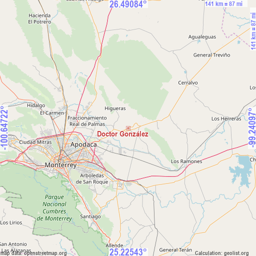
Doctor González GPS coordinates[2]
25° 51' 35.388" North, 99° 56' 38.724" West
| Map corner | latitude | longitude |
|---|---|---|
| Upper-left | 26.49084°, | -100.64722° |
| Center: | 25.85983°, | -99.94409° |
| Lower-right: | 25.22543°, | -99.24097° |
| Map W x H: | 140.7×140.7 km | = 87.4×87.4mi |
| max Lat: | 32.7° ⇑5.3% North |
| Doctor González: | 25.85983° |
| min Lat: | ⇓94.7% South 14.53588° |
| min Long | Doctor Gonzále | max Long |
| -117.105° | -99.94409° | -86.73105° |
| W 36.8%⇐ | ⇒63.2% E |
Elevation
Elevation of Doctor González is 373 m = 1224 ft, and this is 880.7 m = 2889 ft below average elevation for this country.
| Max E: |
3497 m = 11473 ft | 70.9% |
| Avg. | 1253.7 m = 4113 ft | |
| Doctor González | 373 m = 1224 ft | |
Min E: |
-1 m = -3 ft | 29.1% |
See also: Mexico elevation on elevation.city.
Geographical zone
Doctor González is located in North temperate zone (between Tropic of Cancer and the Arctic Circle). Distance of this Northern Tropic circle is 269.4 km =167.4 mi to South.| Distance of | km | miles | from Doctor González |
|---|---|---|---|
| North Pole | 7131.7 | 4431.4 | to North |
| Arctic Circle | 4525.8 | 2812.2 | to North |
| Tropic Cancer | 269.4 | 167.4 | to South |
| Equator | 2875.3 | 1786.6 | to South |


Nearby cities:
15 places around Doctor González: (largest is in red/bold)
• Agua Fría
21 km =13 mi,  255°
255°
• Artemio Treviño
20.1 km =12.5 mi, 262°
• Colinas del Aeropuerto
16.6 km =10.3 mi,  253°
253°
• Dulces Nombres
20.2 km =12.6 mi,  223°
223°
• Fraccionamiento Real Palmas
22.1 km =13.7 mi,  282°
282°
• General Zuazua
16.9 km =10.5 mi, 283°
• Hacienda San Pedro
22.7 km =14.1 mi,  285°
285°
• Higueras
13.2 km =8.2 mi,  327°
327°
• Ladrillera (Entronque Pesquería)
16.9 km =10.5 mi, 248°
• Lomas de San Martín
21.6 km =13.4 mi,  234°
234°
• Marín
8.9 km =5.5 mi, 284°
• Misión San Pablo
24.1 km =15 mi,  236°
236°
• Paseo de San Javier
23.3 km =14.5 mi, 234°
• Pesquería
13.5 km =8.4 mi, 232°
• Zacatecas
17.9 km =11.1 mi, 252°
Sources, notices
• [Note1] Compared only with cities in Mexico existing in our database
• [Src1] Map data: © OpenStreetMap contributors (CC-BY-SA)
• [Src2] Other city data from geonames.org with taken over terms of usage.
• [Src3] Geographical zone / Annual Mean Temperature by Robert A. Rohde @ Wikipedia
