Pesquería geodata
Pesquería (Nuevo León) is a seat of a second-order administrative division; located in Mexico in America/Monterrey (GMT-6) time zone. With population of 5,465 people, there are 1701 cities with bigger population in this country. Compared to other cities in Mexico, 94.2% of cities are located further ↓South; 64.6% of cities are located further →East and 71.8% of cities have higher elevation than Pesquería. Note1


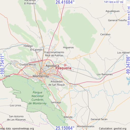
Pesquería GPS coordinates[2]
25° 47' 7.548" North, 100° 3' 3.528" West
| Map corner | latitude | longitude |
|---|---|---|
| Upper-left | 26.41684°, | -100.75411° |
| Center: | 25.78543°, | -100.05098° |
| Lower-right: | 25.15064°, | -99.34786° |
| Map W x H: | 140.8×140.8 km | = 87.5×87.5mi |
| max Lat: | 32.7° ⇑5.8% North |
| Pesquería: | 25.78543° |
| min Lat: | ⇓94.2% South 14.53588° |
| min Long | Pesquería | max Long |
| -117.105° | -100.05098° | -86.73105° |
| W 35.4%⇐ | ⇒64.6% E |
Elevation
Elevation of Pesquería is 334 m = 1096 ft, and this is 919.7 m = 3017 ft below average elevation for this country.
| Max E: |
3497 m = 11473 ft | 71.8% |
| Avg. | 1253.7 m = 4113 ft | |
| Pesquería | 334 m = 1096 ft | |
Min E: |
-1 m = -3 ft | 28.2% |
See also: Mexico elevation on elevation.city.
Geographical zone
Pesquería is located in North temperate zone (between Tropic of Cancer and the Arctic Circle). Distance of this Northern Tropic circle is 261.2 km =162.3 mi to South.| Distance of | km | miles | from Pesquería |
|---|---|---|---|
| North Pole | 7140 | 4436.6 | to North |
| Arctic Circle | 4534.1 | 2817.4 | to North |
| Tropic Cancer | 261.2 | 162.3 | to South |
| Equator | 2867.1 | 1781.5 | to South |


Nearby cities:
15 places around Pesquería: (largest is in red/bold)
• Agua Fría
10 km =6.2 mi,  287°
287°
• Artemio Treviño
10.7 km =6.6 mi,  301°
301°
• Colinas del Aeropuerto
6.2 km =3.9 mi, 304°
• Doctor González
13.5 km =8.4 mi,  52°
52°
• Dulces Nombres
7.1 km =4.4 mi,  207°
207°
• Fraccionamiento Misión de San Javier
11 km =6.8 mi,  246°
246°
• General Zuazua
13.4 km =8.3 mi,  334°
334°
• Ladrillera (Entronque Pesquería)
5.4 km =3.4 mi, 291°
• Loma la Paz
11.8 km =7.3 mi,  225°
225°
• Lomas de San Martín
8.1 km =5 mi,  238°
238°
• Los Olmos
10.6 km =6.6 mi, 236°
• Marín
10.7 km =6.6 mi,  11°
11°
• Misión San Pablo
10.6 km =6.6 mi, 241°
• Paseo de San Javier
9.8 km =6.1 mi, 238°
• Zacatecas
7 km =4.3 mi, 294°
Sources, notices
• [Note1] Compared only with cities in Mexico existing in our database
• [Src1] Map data: © OpenStreetMap contributors (CC-BY-SA)
• [Src2] Other city data from geonames.org with taken over terms of usage.
• [Src3] Geographical zone / Annual Mean Temperature by Robert A. Rohde @ Wikipedia
