Contla geodata
Contla (Puebla) is a populated place; located in Mexico in America/Mexico_City (GMT-6) time zone. With population of 776 people, there are 11259 cities with bigger population in this country. Compared to other cities in Mexico, 50.5% of cities are located further ↑North; 67.1% of cities are located further ←West and 74% of cities have lower elevation than Contla. Note1


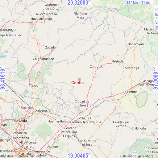
Contla GPS coordinates[2]
19° 40' 5.196" North, 97° 42' 46.908" West
| Map corner | latitude | longitude |
|---|---|---|
| Upper-left | 20.32883°, | -98.41616° |
| Center: | 19.66811°, | -97.71303° |
| Lower-right: | 19.00465°, | -97.00991° |
| Map W x H: | 147.2×147.2 km | = 91.5×91.5mi |
| max Lat: | 32.7° ⇑50.5% North |
| Contla: | 19.66811° |
| min Lat: | ⇓49.5% South 14.53588° |
| min Long | Contla | max Long |
| -117.105° | -97.71303° | -86.73105° |
| W 67.1%⇐ | ⇒32.9% E |
Elevation
Elevation of Contla is 2011 m = 6598 ft, and this is 757.3 m = 2485 ft above average elevation for this country.
| Max E: |
3497 m = 11473 ft | 26% |
| Contla | 2011 m 6598 ft | |
| Avg. | 1253.7 m = 4113 ft | |
Min E: |
-1 m = -3 ft | 74% |
See also: Mexico elevation on elevation.city.
Geographical zone
Contla is located in North Torrid zone (between Equator and Tropic of Cancer). Distance of this Northern Tropic circle is 419 km =260.4 mi to North.| Distance of | km | miles | from Contla |
|---|---|---|---|
| North Pole | 7820.2 | 4859.2 | to North |
| Arctic Circle | 5214.3 | 3240 | to North |
| Tropic Cancer | 419 | 260.4 | to North |
| Equator | 2186.9 | 1358.9 | to South |


Nearby cities:
15 places around Contla: (largest is in red/bold)
• Chilapa
12.4 km =7.7 mi,  29°
29°
• Cuyoaco
12.2 km =7.6 mi,  127°
127°
• Emilio Carranza (Santa Cruz)
8 km =5 mi,  51°
51°
• Guadalupe Victoria
13.3 km =8.3 mi,  155°
155°
• Ixtacamaxtitlán
11.8 km =7.3 mi,  245°
245°
• La Unión Ejido Mexcaltepec
6.7 km =4.2 mi,  177°
177°
• San Andrés Yahuitlalpan
1.6 km =1 mi,  291°
291°
• San Francisco del Progreso
12.9 km =8 mi,  57°
57°
• San Miguel Tenextatiloyan
12.9 km =8 mi,  69°
69°
• Tateno
6.8 km =4.2 mi,  186°
186°
• Temextla
8.1 km =5 mi,  143°
143°
• Tentzoncuahuigtic
9.1 km =5.7 mi,  281°
281°
• Tepexoxuca
9.2 km =5.7 mi,  206°
206°
• Tlamanca
1.9 km =1.2 mi, 67°
• Zautla
6.8 km =4.2 mi,  40°
40°
Sources, notices
• [Note1] Compared only with cities in Mexico existing in our database
• [Src1] Map data: © OpenStreetMap contributors (CC-BY-SA)
• [Src2] Other city data from geonames.org with taken over terms of usage.
• [Src3] Geographical zone / Annual Mean Temperature by Robert A. Rohde @ Wikipedia
