Cuyoaco geodata
Cuyoaco (Puebla) is a populated place; located in Mexico in America/Mexico_City (GMT-6) time zone. With population of 1,903 people, there are 4568 cities with bigger population in this country. Compared to other cities in Mexico, 51.8% of cities are located further ↑North; 68.2% of cities are located further ←West and 90.8% of cities have lower elevation than Cuyoaco. Note1


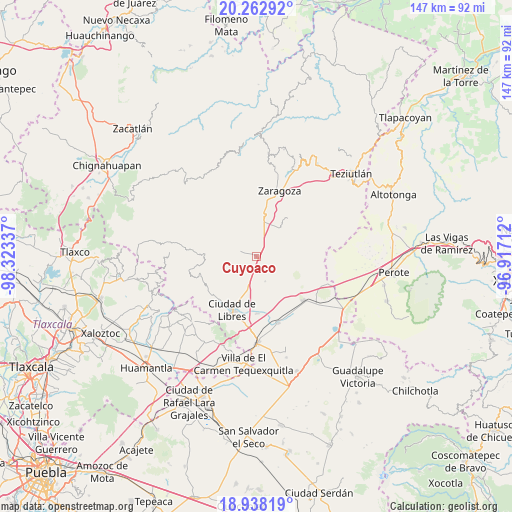
Cuyoaco GPS coordinates[2]
19° 36' 6.912" North, 97° 37' 12.864" West
| Map corner | latitude | longitude |
|---|---|---|
| Upper-left | 20.26292°, | -98.32337° |
| Center: | 19.60192°, | -97.62024° |
| Lower-right: | 18.93819°, | -96.91712° |
| Map W x H: | 147.3×147.3 km | = 91.5×91.5mi |
| max Lat: | 32.7° ⇑51.8% North |
| Cuyoaco: | 19.60192° |
| min Lat: | ⇓48.2% South 14.53588° |
| min Long | Cuyoaco | max Long |
| -117.105° | -97.62024° | -86.73105° |
| W 68.2%⇐ | ⇒31.8% E |
Elevation
Elevation of Cuyoaco is 2435 m = 7989 ft, and this is 1181.3 m = 3876 ft above average elevation for this country.
| Max E: |
3497 m = 11473 ft | 9.2% |
| Cuyoaco | 2435 m 7989 ft | |
| Avg. | 1253.7 m = 4113 ft | |
Min E: |
-1 m = -3 ft | 90.8% |
See also: Mexico elevation on elevation.city.
Geographical zone
Cuyoaco is located in North Torrid zone (between Equator and Tropic of Cancer). Distance of this Northern Tropic circle is 426.4 km =265 mi to North.| Distance of | km | miles | from Cuyoaco |
|---|---|---|---|
| North Pole | 7827.5 | 4863.8 | to North |
| Arctic Circle | 5221.6 | 3244.6 | to North |
| Tropic Cancer | 426.4 | 265 | to North |
| Equator | 2179.5 | 1354.3 | to South |


Nearby cities:
15 places around Cuyoaco: (largest is in red/bold)
• Allende
7.4 km =4.6 mi,  160°
160°
• Contla
12.2 km =7.6 mi,  307°
307°
• El Mirador (San Francisco)
8.5 km =5.3 mi,  211°
211°
• Guadalupe Victoria
6.3 km =3.9 mi,  221°
221°
• Guadalupe Victoria
10 km =6.2 mi,  63°
63°
• Huitzitzilapan
12 km =7.5 mi,  20°
20°
• La Unión Ejido Mexcaltepec
9.5 km =5.9 mi,  274°
274°
• Ocotepec
6.1 km =3.8 mi, 211°
• San Andrés Payuca
8.5 km =5.3 mi,  178°
178°
• San Miguel Tenextatiloyan
12.2 km =7.6 mi,  11°
11°
• Tateno
10.6 km =6.6 mi, 273°
• Tehuatzingo
10.9 km =6.8 mi, 213°
• Temextla
5 km =3.1 mi,  279°
279°
• Texcal
9.2 km =5.7 mi,  98°
98°
• Tlamanca
11.4 km =7.1 mi,  315°
315°
Sources, notices
• [Note1] Compared only with cities in Mexico existing in our database
• [Src1] Map data: © OpenStreetMap contributors (CC-BY-SA)
• [Src2] Other city data from geonames.org with taken over terms of usage.
• [Src3] Geographical zone / Annual Mean Temperature by Robert A. Rohde @ Wikipedia
