Chicoasén geodata
Chicoasén (Chiapas) is a seat of a second-order administrative division; located in Mexico in America/Mexico_City (GMT-6) time zone. With population of 3,343 people, there are 2721 cities with bigger population in this country. Compared to other cities in Mexico, 89.4% of cities are located further ↑North; 88.1% of cities are located further ←West and 74.4% of cities have higher elevation than Chicoasén. Note1


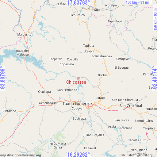
Chicoasén GPS coordinates[2]
16° 57' 58.788" North, 93° 6' 17.496" West
| Map corner | latitude | longitude |
|---|---|---|
| Upper-left | 17.63763°, | -93.80799° |
| Center: | 16.96633°, | -93.10486° |
| Lower-right: | 16.29262°, | -92.40174° |
| Map W x H: | 149.6×149.6 km | = 93×93mi |
| max Lat: | 32.7° ⇑89.4% North |
| Chicoasén: | 16.96633° |
| min Lat: | ⇓10.6% South 14.53588° |
| min Long | Chicoasén | max Long |
| -117.105° | -93.10486° | -86.73105° |
| W 88.1%⇐ | ⇒11.9% E |
Elevation
Elevation of Chicoasén is 239 m = 784 ft, and this is 1014.7 m = 3329 ft below average elevation for this country.
| Max E: |
3497 m = 11473 ft | 74.4% |
| Avg. | 1253.7 m = 4113 ft | |
| Chicoasén | 239 m = 784 ft | |
Min E: |
-1 m = -3 ft | 25.6% |
See also: Mexico elevation on elevation.city.
Geographical zone
Chicoasén is located in North Torrid zone (between Equator and Tropic of Cancer). Distance of this Northern Tropic circle is 719.4 km =447 mi to North.| Distance of | km | miles | from Chicoasén |
|---|---|---|---|
| North Pole | 8120.6 | 5045.9 | to North |
| Arctic Circle | 5514.7 | 3426.7 | to North |
| Tropic Cancer | 719.4 | 447 | to North |
| Equator | 1886.5 | 1172.2 | to South |


Nearby cities:
15 places around Chicoasén: (largest is in red/bold)
• Benito Juárez
12.9 km =8 mi,  224°
224°
• Cuauhtémoc
13 km =8.1 mi,  252°
252°
• El Carmelo
4.2 km =2.6 mi,  203°
203°
• Francisco Sarabia
10 km =6.2 mi,  103°
103°
• Gabriel Esquinca
8 km =5 mi, 249°
• Garrido Canaval
14.6 km =9.1 mi,  34°
34°
• José María Morelos y Pavón
12.3 km =7.6 mi,  346°
346°
• La Nueva
11.4 km =7.1 mi,  325°
325°
• Libertad Campesina
12.4 km =7.7 mi,  141°
141°
• Llano Grande
15.1 km =9.4 mi,  60°
60°
• Luis Espinoza
11 km =6.8 mi,  48°
48°
• Osumacinta
3.7 km =2.3 mi,  155°
155°
• San Antonio Zaragoza
9.2 km =5.7 mi,  124°
124°
• Triunfo Agrarista
12.9 km =8 mi, 163°
• Venustiano Carranza
13.2 km =8.2 mi,  126°
126°
Sources, notices
• [Note1] Compared only with cities in Mexico existing in our database
• [Src1] Map data: © OpenStreetMap contributors (CC-BY-SA)
• [Src2] Other city data from geonames.org with taken over terms of usage.
• [Src3] Geographical zone / Annual Mean Temperature by Robert A. Rohde @ Wikipedia
