Chichatla geodata
Chichatla (Hidalgo) is a populated place; located in Mexico in America/Mexico_City (GMT-6) time zone. With population of 1,098 people, there are 7922 cities with bigger population in this country. Compared to other cities in Mexico, 75.9% of cities are located further ↓South; 55.8% of cities are located further ←West and 58.2% of cities have higher elevation than Chichatla. Note1


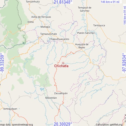
Chichatla GPS coordinates[2]
20° 57' 29.988" North, 98° 37' 46.056" West
| Map corner | latitude | longitude |
|---|---|---|
| Upper-left | 21.61348°, | -99.33259° |
| Center: | 20.95833°, | -98.62946° |
| Lower-right: | 20.30029°, | -97.92634° |
| Map W x H: | 146×146 km | = 90.7×90.7mi |
| max Lat: | 32.7° ⇑24.1% North |
| Chichatla: | 20.95833° |
| min Lat: | ⇓75.9% South 14.53588° |
| min Long | Chichatla | max Long |
| -117.105° | -98.62946° | -86.73105° |
| W 55.8%⇐ | ⇒44.2% E |
Elevation
Elevation of Chichatla is 1095 m = 3593 ft, and this is 158.7 m = 521 ft below average elevation for this country.
| Max E: |
3497 m = 11473 ft | 58.2% |
| Avg. | 1253.7 m = 4113 ft | |
| Chichatla | 1095 m = 3593 ft | |
Min E: |
-1 m = -3 ft | 41.8% |
See also: Mexico elevation on elevation.city.
Geographical zone
Chichatla is located in North Torrid zone (between Equator and Tropic of Cancer). Distance of this Northern Tropic circle is 275.6 km =171.2 mi to North.| Distance of | km | miles | from Chichatla |
|---|---|---|---|
| North Pole | 7676.7 | 4770.1 | to North |
| Arctic Circle | 5070.8 | 3150.8 | to North |
| Tropic Cancer | 275.6 | 171.2 | to North |
| Equator | 2330.3 | 1448 | to South |


Nearby cities:
15 places around Chichatla: (largest is in red/bold)
• Acahuasco
3.4 km =2.1 mi,  82°
82°
• Ahuacatlán
7.8 km =4.8 mi,  191°
191°
• Apantlazol
5.9 km =3.7 mi,  53°
53°
• Calnali
8.2 km =5.1 mi,  146°
146°
• Chipoco
7.9 km =4.9 mi,  283°
283°
• Olotla
6.8 km =4.2 mi,  69°
69°
• Peyula
10.8 km =6.7 mi,  33°
33°
• Pilcuatla
8.2 km =5.1 mi,  96°
96°
• San Andrés (San Andrés Chichayotla)
7.7 km =4.8 mi,  117°
117°
• San Cristóbal
3.4 km =2.1 mi,  265°
265°
• Tecpaco
5.1 km =3.2 mi,  128°
128°
• Tlamamala
9.2 km =5.7 mi, 82°
• Tlanchinol
4.7 km =2.9 mi,  322°
322°
• Toctitlán
7.7 km =4.8 mi,  40°
40°
• Tolago
10.5 km =6.5 mi, 282°
Sources, notices
• [Note1] Compared only with cities in Mexico existing in our database
• [Src1] Map data: © OpenStreetMap contributors (CC-BY-SA)
• [Src2] Other city data from geonames.org with taken over terms of usage.
• [Src3] Geographical zone / Annual Mean Temperature by Robert A. Rohde @ Wikipedia
