Peyula geodata
Peyula (Hidalgo) is a populated place; located in Mexico in America/Mexico_City (GMT-6) time zone. With population of 502 people, there are 16762 cities with bigger population in this country. Compared to other cities in Mexico, 77% of cities are located further ↓South; 56.4% of cities are located further ←West and 68.2% of cities have higher elevation than Peyula. Note1


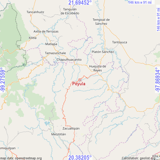
Peyula GPS coordinates[2]
21° 2' 23.028" North, 98° 34' 20.856" West
| Map corner | latitude | longitude |
|---|---|---|
| Upper-left | 21.69452°, | -99.27559° |
| Center: | 21.03973°, | -98.57246° |
| Lower-right: | 20.38205°, | -97.86934° |
| Map W x H: | 145.9×145.9 km | = 90.7×90.7mi |
| max Lat: | 32.7° ⇑23% North |
| Peyula: | 21.03973° |
| min Lat: | ⇓77% South 14.53588° |
| min Long | Peyula | max Long |
| -117.105° | -98.57246° | -86.73105° |
| W 56.4%⇐ | ⇒43.6% E |
Elevation
Elevation of Peyula is 516 m = 1693 ft, and this is 737.7 m = 2420 ft below average elevation for this country.
| Max E: |
3497 m = 11473 ft | 68.2% |
| Avg. | 1253.7 m = 4113 ft | |
| Peyula | 516 m = 1693 ft | |
Min E: |
-1 m = -3 ft | 31.8% |
See also: Mexico elevation on elevation.city.
Geographical zone
Peyula is located in North Torrid zone (between Equator and Tropic of Cancer). Distance of this Northern Tropic circle is 266.5 km =165.6 mi to North.| Distance of | km | miles | from Peyula |
|---|---|---|---|
| North Pole | 7667.7 | 4764.5 | to North |
| Arctic Circle | 5061.8 | 3145.3 | to North |
| Tropic Cancer | 266.5 | 165.6 | to North |
| Equator | 2339.4 | 1453.6 | to South |


Nearby cities:
15 places around Peyula: (largest is in red/bold)
• Acahuasco
8.9 km =5.5 mi,  196°
196°
• Acatipa
1.4 km =0.9 mi,  333°
333°
• Apantlazol
5.7 km =3.5 mi,  191°
191°
• Axcaco
4.7 km =2.9 mi,  44°
44°
• Chatipán
5.2 km =3.2 mi,  115°
115°
• Coacuilco
7.3 km =4.5 mi,  348°
348°
• Ixcatlán
6.1 km =3.8 mi, 40°
• Ixcatépec
8.8 km =5.5 mi, 39°
• Machetla
8.4 km =5.2 mi,  74°
74°
• Olotla
6.7 km =4.2 mi,  176°
176°
• San Francisco
9.2 km =5.7 mi,  105°
105°
• San José
4 km =2.5 mi, 325°
• Tehuetlán
6.8 km =4.2 mi,  77°
77°
• Tlamamala
8.5 km =5.3 mi,  157°
157°
• Toctitlán
3.3 km =2.1 mi, 196°
Sources, notices
• [Note1] Compared only with cities in Mexico existing in our database
• [Src1] Map data: © OpenStreetMap contributors (CC-BY-SA)
• [Src2] Other city data from geonames.org with taken over terms of usage.
• [Src3] Geographical zone / Annual Mean Temperature by Robert A. Rohde @ Wikipedia
