Tlamamala geodata
Tlamamala (Hidalgo) is a populated place; located in Mexico in America/Mexico_City (GMT-6) time zone. With population of 744 people, there are 11771 cities with bigger population in this country. Compared to other cities in Mexico, 76% of cities are located further ↓South; 56.7% of cities are located further ←West and 60.5% of cities have higher elevation than Tlamamala. Note1


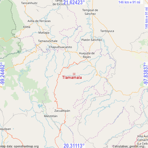
Tlamamala GPS coordinates[2]
20° 58' 8.832" North, 98° 32' 29.364" West
| Map corner | latitude | longitude |
|---|---|---|
| Upper-left | 21.62423°, | -99.24462° |
| Center: | 20.96912°, | -98.54149° |
| Lower-right: | 20.31113°, | -97.83837° |
| Map W x H: | 146×146 km | = 90.7×90.7mi |
| max Lat: | 32.7° ⇑24% North |
| Tlamamala: | 20.96912° |
| min Lat: | ⇓76% South 14.53588° |
| min Long | Tlamamala | max Long |
| -117.105° | -98.54149° | -86.73105° |
| W 56.7%⇐ | ⇒43.3% E |
Elevation
Elevation of Tlamamala is 973 m = 3192 ft, and this is 280.7 m = 921 ft below average elevation for this country.
| Max E: |
3497 m = 11473 ft | 60.5% |
| Avg. | 1253.7 m = 4113 ft | |
| Tlamamala | 973 m = 3192 ft | |
Min E: |
-1 m = -3 ft | 39.5% |
See also: Mexico elevation on elevation.city.
Geographical zone
Tlamamala is located in North Torrid zone (between Equator and Tropic of Cancer). Distance of this Northern Tropic circle is 274.4 km =170.5 mi to North.| Distance of | km | miles | from Tlamamala |
|---|---|---|---|
| North Pole | 7675.5 | 4769.3 | to North |
| Arctic Circle | 5069.6 | 3150.1 | to North |
| Tropic Cancer | 274.4 | 170.5 | to North |
| Equator | 2331.5 | 1448.7 | to South |


Nearby cities:
15 places around Tlamamala: (largest is in red/bold)
• Acahuasco
5.8 km =3.6 mi,  262°
262°
• Apantlazol
4.9 km =3 mi,  297°
297°
• Calnali
9.2 km =5.7 mi,  209°
209°
• Chatipán
5.9 km =3.7 mi,  14°
14°
• Chichatla
9.2 km =5.7 mi, 262°
• Coamitla
8.9 km =5.5 mi,  148°
148°
• Coyula
7.7 km =4.8 mi,  128°
128°
• Huazalingo
3.7 km =2.3 mi,  69°
69°
• Olotla
3.1 km =1.9 mi,  292°
292°
• Peyula
8.5 km =5.3 mi,  337°
337°
• Pilcuatla
2.3 km =1.4 mi,  204°
204°
• San Andrés (San Andrés Chichayotla)
5.2 km =3.2 mi, 205°
• San Francisco
7.9 km =4.9 mi,  46°
46°
• Tecpaco
6.7 km =4.2 mi,  229°
229°
• Toctitlán
6.3 km =3.9 mi,  318°
318°
Sources, notices
• [Note1] Compared only with cities in Mexico existing in our database
• [Src1] Map data: © OpenStreetMap contributors (CC-BY-SA)
• [Src2] Other city data from geonames.org with taken over terms of usage.
• [Src3] Geographical zone / Annual Mean Temperature by Robert A. Rohde @ Wikipedia
