Tecpaco geodata
Tecpaco (Hidalgo) is a populated place; located in Mexico in America/Mexico_City (GMT-6) time zone. With population of 630 people, there are 13737 cities with bigger population in this country. Compared to other cities in Mexico, 75.3% of cities are located further ↓South; 56.2% of cities are located further ←West and 52.8% of cities have higher elevation than Tecpaco. Note1


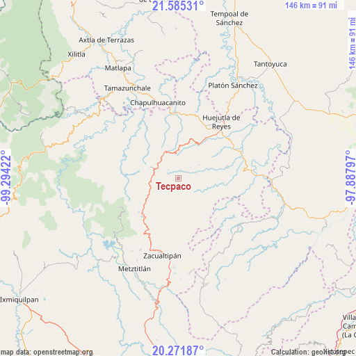
Tecpaco GPS coordinates[2]
20° 55' 48.108" North, 98° 35' 27.924" West
| Map corner | latitude | longitude |
|---|---|---|
| Upper-left | 21.58531°, | -99.29422° |
| Center: | 20.93003°, | -98.59109° |
| Lower-right: | 20.27187°, | -97.88797° |
| Map W x H: | 146×146 km | = 90.7×90.7mi |
| max Lat: | 32.7° ⇑24.7% North |
| Tecpaco: | 20.93003° |
| min Lat: | ⇓75.3% South 14.53588° |
| min Long | Tecpaco | max Long |
| -117.105° | -98.59109° | -86.73105° |
| W 56.2%⇐ | ⇒43.8% E |
Elevation
Elevation of Tecpaco is 1302 m = 4272 ft, and this is 48.3 m = 158 ft above average elevation for this country.
| Max E: |
3497 m = 11473 ft | 52.8% |
| Tecpaco | 1302 m 4272 ft | |
| Avg. | 1253.7 m = 4113 ft | |
Min E: |
-1 m = -3 ft | 47.2% |
See also: Mexico elevation on elevation.city.
Geographical zone
Tecpaco is located in North Torrid zone (between Equator and Tropic of Cancer). Distance of this Northern Tropic circle is 278.7 km =173.2 mi to North.| Distance of | km | miles | from Tecpaco |
|---|---|---|---|
| North Pole | 7679.9 | 4772.1 | to North |
| Arctic Circle | 5074 | 3152.8 | to North |
| Tropic Cancer | 278.7 | 173.2 | to North |
| Equator | 2327.2 | 1446.1 | to South |


Nearby cities:
15 places around Tecpaco: (largest is in red/bold)
• Acahuasco
3.7 km =2.3 mi,  351°
351°
• Ahuacatlán
7.2 km =4.5 mi,  231°
231°
• Apantlazol
6.7 km =4.2 mi,  6°
6°
• Calnali
3.7 km =2.3 mi,  170°
170°
• Chichatla
5.1 km =3.2 mi,  308°
308°
• Coamitla
10.3 km =6.4 mi,  108°
108°
• Huazalingo
10.3 km =6.4 mi,  56°
56°
• Olotla
6 km =3.7 mi,  22°
22°
• Pilcuatla
4.8 km =3 mi, 61°
• San Andrés (San Andrés Chichayotla)
2.9 km =1.8 mi,  97°
97°
• San Cristóbal
7.9 km =4.9 mi,  291°
291°
• Tlamamala
6.7 km =4.2 mi,  49°
49°
• Tlanchinol
9.7 km =6 mi,  315°
315°
• Toctitlán
9.1 km =5.7 mi, 6°
• Tuzancoac
9.2 km =5.7 mi,  155°
155°
Sources, notices
• [Note1] Compared only with cities in Mexico existing in our database
• [Src1] Map data: © OpenStreetMap contributors (CC-BY-SA)
• [Src2] Other city data from geonames.org with taken over terms of usage.
• [Src3] Geographical zone / Annual Mean Temperature by Robert A. Rohde @ Wikipedia
