Acahuasco geodata
Acahuasco (Hidalgo) is a populated place; located in Mexico in America/Mexico_City (GMT-6) time zone. With population of 1,289 people, there are 6729 cities with bigger population in this country. Compared to other cities in Mexico, 75.9% of cities are located further ↓South; 56.1% of cities are located further ←West and 61.8% of cities have higher elevation than Acahuasco. Note1


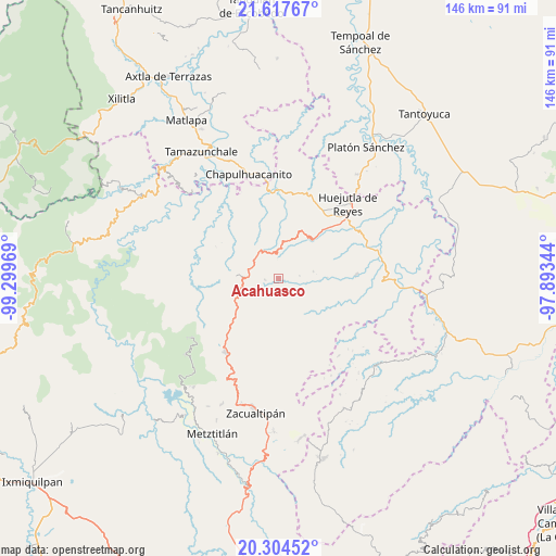
Acahuasco GPS coordinates[2]
20° 57' 45.144" North, 98° 35' 47.616" West
| Map corner | latitude | longitude |
|---|---|---|
| Upper-left | 21.61767°, | -99.29969° |
| Center: | 20.96254°, | -98.59656° |
| Lower-right: | 20.30452°, | -97.89344° |
| Map W x H: | 146×146 km | = 90.7×90.7mi |
| max Lat: | 32.7° ⇑24.1% North |
| Acahuasco: | 20.96254° |
| min Lat: | ⇓75.9% South 14.53588° |
| min Long | Acahuasco | max Long |
| -117.105° | -98.59656° | -86.73105° |
| W 56.1%⇐ | ⇒43.9% E |
Elevation
Elevation of Acahuasco is 888 m = 2913 ft, and this is 365.7 m = 1200 ft below average elevation for this country.
| Max E: |
3497 m = 11473 ft | 61.8% |
| Avg. | 1253.7 m = 4113 ft | |
| Acahuasco | 888 m = 2913 ft | |
Min E: |
-1 m = -3 ft | 38.2% |
See also: Mexico elevation on elevation.city.
Geographical zone
Acahuasco is located in North Torrid zone (between Equator and Tropic of Cancer). Distance of this Northern Tropic circle is 275.1 km =170.9 mi to North.| Distance of | km | miles | from Acahuasco |
|---|---|---|---|
| North Pole | 7676.2 | 4769.8 | to North |
| Arctic Circle | 5070.4 | 3150.6 | to North |
| Tropic Cancer | 275.1 | 170.9 | to North |
| Equator | 2330.8 | 1448.3 | to South |


Nearby cities:
15 places around Acahuasco: (largest is in red/bold)
• Ahuacatlán
9.5 km =5.9 mi,  211°
211°
• Apantlazol
3.3 km =2.1 mi,  24°
24°
• Calnali
7.4 km =4.6 mi,  170°
170°
• Chatipán
9.6 km =6 mi,  48°
48°
• Chichatla
3.4 km =2.1 mi,  262°
262°
• Huazalingo
9.4 km =5.8 mi,  77°
77°
• Olotla
3.5 km =2.2 mi,  56°
56°
• Peyula
8.9 km =5.5 mi, 16°
• Pilcuatla
5 km =3.1 mi,  106°
106°
• San Andrés (San Andrés Chichayotla)
5.3 km =3.3 mi,  139°
139°
• San Cristóbal
6.8 km =4.2 mi, 263°
• Tecpaco
3.7 km =2.3 mi, 171°
• Tlamamala
5.8 km =3.6 mi, 82°
• Tlanchinol
7.1 km =4.4 mi,  297°
297°
• Toctitlán
5.6 km =3.5 mi, 15°
Sources, notices
• [Note1] Compared only with cities in Mexico existing in our database
• [Src1] Map data: © OpenStreetMap contributors (CC-BY-SA)
• [Src2] Other city data from geonames.org with taken over terms of usage.
• [Src3] Geographical zone / Annual Mean Temperature by Robert A. Rohde @ Wikipedia
