Miguel Bocanegra geodata
Miguel Bocanegra (Morelos) is a populated place; located in Mexico in America/Mexico_City (GMT-6) time zone. With population of 5,681 people, there are 1640 cities with bigger population in this country. Compared to other cities in Mexico, 54% of cities are located further ↓South; 51.3% of cities are located further →East and 86% of cities have lower elevation than Miguel Bocanegra. Note1


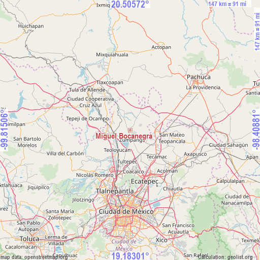
Miguel Bocanegra GPS coordinates[2]
19° 50' 44.664" North, 99° 6' 42.948" West
| Map corner | latitude | longitude |
|---|---|---|
| Upper-left | 20.50572°, | -99.81506° |
| Center: | 19.84574°, | -99.11193° |
| Lower-right: | 19.18301°, | -98.40881° |
| Map W x H: | 147.1×147.1 km | = 91.4×91.4mi |
| max Lat: | 32.7° ⇑46% North |
| Miguel Bocanegra: | 19.84574° |
| min Lat: | ⇓54% South 14.53588° |
| min Long | Miguel Bocanegr | max Long |
| -117.105° | -99.11193° | -86.73105° |
| W 48.7%⇐ | ⇒51.3% E |
Elevation
Elevation of Miguel Bocanegra is 2281 m = 7484 ft, and this is 1027.3 m = 3370 ft above average elevation for this country.
| Max E: |
3497 m = 11473 ft | 14% |
| Miguel Bocanegra | 2281 m 7484 ft | |
| Avg. | 1253.7 m = 4113 ft | |
Min E: |
-1 m = -3 ft | 86% |
See also: Mexico elevation on elevation.city.
Geographical zone
Miguel Bocanegra is located in North Torrid zone (between Equator and Tropic of Cancer). Distance of this Northern Tropic circle is 399.3 km =248.1 mi to North.| Distance of | km | miles | from Miguel Bocanegra |
|---|---|---|---|
| North Pole | 7800.4 | 4846.9 | to North |
| Arctic Circle | 5194.5 | 3227.7 | to North |
| Tropic Cancer | 399.3 | 248.1 | to North |
| Equator | 2206.6 | 1371.1 | to South |


Nearby cities:
15 places around Miguel Bocanegra: (largest is in red/bold)
• Barrio de España
3.6 km =2.2 mi,  61°
61°
• Barrio el Rincón
4.5 km =2.8 mi,  46°
46°
• Colonia Wenceslao Labra
2.4 km =1.5 mi,  212°
212°
• El Llano Santa María
7.4 km =4.6 mi,  158°
158°
• Fraccionamiento la Trinidad
3.6 km =2.2 mi,  121°
121°
• Jilotzingo
5.8 km =3.6 mi, 63°
• Loma Larga (Barrio de Loma Larga)
2.4 km =1.5 mi,  349°
349°
• San Juan Zitlaltepec
5.1 km =3.2 mi,  222°
222°
• San Miguel
3.5 km =2.2 mi,  317°
317°
• San Miguel Bocanegra
0.2 km =0.1 mi,  189°
189°
• Santa María Cuevas
2.7 km =1.7 mi,  31°
31°
• Santa María I y II
3 km =1.9 mi,  146°
146°
• Santa María de Guadalupe
3.2 km =2 mi, 211°
• Villas de la Laguna
2.5 km =1.6 mi, 115°
• Zumpango
5.6 km =3.5 mi,  166°
166°
Sources, notices
• [Note1] Compared only with cities in Mexico existing in our database
• [Src1] Map data: © OpenStreetMap contributors (CC-BY-SA)
• [Src2] Other city data from geonames.org with taken over terms of usage.
• [Src3] Geographical zone / Annual Mean Temperature by Robert A. Rohde @ Wikipedia
