San Juan Zitlaltepec geodata
San Juan Zitlaltepec (Morelos) is a populated place; located in Mexico in America/Mexico_City (GMT-6) time zone. With population of 19,600 people, there are 510 cities with bigger population in this country. Compared to other cities in Mexico, 53.1% of cities are located further ↓South; 51.7% of cities are located further →East and 86.1% of cities have lower elevation than San Juan Zitlaltepec. Note1


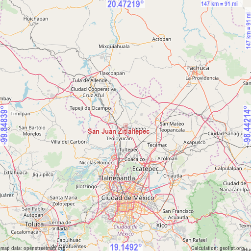
San Juan Zitlaltepec GPS coordinates[2]
19° 48' 43.452" North, 99° 8' 42.936" West
| Map corner | latitude | longitude |
|---|---|---|
| Upper-left | 20.47219°, | -99.84839° |
| Center: | 19.81207°, | -99.14526° |
| Lower-right: | 19.1492°, | -98.44214° |
| Map W x H: | 147.1×147.1 km | = 91.4×91.4mi |
| max Lat: | 32.7° ⇑46.9% North |
| San Juan Zitlaltepec: | 19.81207° |
| min Lat: | ⇓53.1% South 14.53588° |
| min Long | San Juan Zitlal | max Long |
| -117.105° | -99.14526° | -86.73105° |
| W 48.3%⇐ | ⇒51.7% E |
Elevation
Elevation of San Juan Zitlaltepec is 2284 m = 7493 ft, and this is 1030.3 m = 3380 ft above average elevation for this country.
| Max E: |
3497 m = 11473 ft | 13.9% |
| San Juan Zitlaltepec | 2284 m 7493 ft | |
| Avg. | 1253.7 m = 4113 ft | |
Min E: |
-1 m = -3 ft | 86.1% |
See also: Mexico elevation on elevation.city.
Geographical zone
San Juan Zitlaltepec is located in North Torrid zone (between Equator and Tropic of Cancer). Distance of this Northern Tropic circle is 403 km =250.4 mi to North.| Distance of | km | miles | from San Juan Zitlaltepec |
|---|---|---|---|
| North Pole | 7804.2 | 4849.3 | to North |
| Arctic Circle | 5198.3 | 3230.1 | to North |
| Tropic Cancer | 403 | 250.4 | to North |
| Equator | 2202.9 | 1368.8 | to South |


Nearby cities:
15 places around San Juan Zitlaltepec: (largest is in red/bold)
• Colonia Pueblo Nuevo (Hacienda San Rosendo)
5.4 km =3.4 mi,  152°
152°
• Colonia Wenceslao Labra
2.8 km =1.7 mi,  51°
51°
• Ex-hacienda de Xalpa
4.1 km =2.5 mi,  284°
284°
• Huehuetoca
6.4 km =4 mi,  286°
286°
• La Planada
5.2 km =3.2 mi,  228°
228°
• La Providencia
6 km =3.7 mi,  181°
181°
• Miguel Bocanegra
5.1 km =3.2 mi,  42°
42°
• San Bartolo
5.5 km =3.4 mi,  295°
295°
• San Miguel
6.4 km =4 mi,  10°
10°
• San Miguel Bocanegra
5 km =3.1 mi, 44°
• San Pedro Xalpa
4.4 km =2.7 mi, 291°
• Santa María I y II
5.3 km =3.3 mi,  76°
76°
• Santa María de Guadalupe
2.1 km =1.3 mi,  61°
61°
• Villas de la Laguna
6.4 km =4 mi,  65°
65°
• Zumpango
5.1 km =3.2 mi,  109°
109°
Sources, notices
• [Note1] Compared only with cities in Mexico existing in our database
• [Src1] Map data: © OpenStreetMap contributors (CC-BY-SA)
• [Src2] Other city data from geonames.org with taken over terms of usage.
• [Src3] Geographical zone / Annual Mean Temperature by Robert A. Rohde @ Wikipedia
