Bernal geodata
Bernal (Querétaro) is a populated place; located in Mexico in America/Mexico_City (GMT-6) time zone. With population of 3,965 people, there are 2297 cities with bigger population in this country. Compared to other cities in Mexico, 72.4% of cities are located further ↓South; 63.2% of cities are located further →East and 77% of cities have lower elevation than Bernal. Note1


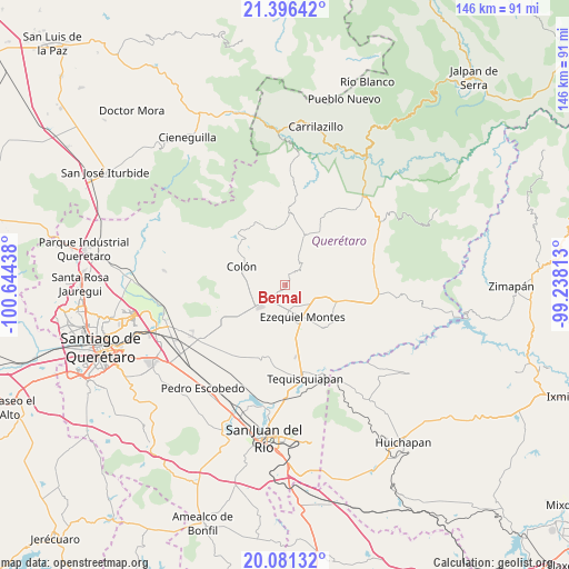
Bernal GPS coordinates[2]
20° 44' 25.08" North, 99° 56' 28.5" West
| Map corner | latitude | longitude |
|---|---|---|
| Upper-left | 21.39642°, | -100.64438° |
| Center: | 20.7403°, | -99.94125° |
| Lower-right: | 20.08132°, | -99.23813° |
| Map W x H: | 146.2×146.2 km | = 90.8×90.8mi |
| max Lat: | 32.7° ⇑27.6% North |
| Bernal: | 20.7403° |
| min Lat: | ⇓72.4% South 14.53588° |
| min Long | Bernal | max Long |
| -117.105° | -99.94125° | -86.73105° |
| W 36.8%⇐ | ⇒63.2% E |
Elevation
Elevation of Bernal is 2069 m = 6788 ft, and this is 815.3 m = 2675 ft above average elevation for this country.
| Max E: |
3497 m = 11473 ft | 23% |
| Bernal | 2069 m 6788 ft | |
| Avg. | 1253.7 m = 4113 ft | |
Min E: |
-1 m = -3 ft | 77% |
See also: Mexico elevation on elevation.city.
Geographical zone
Bernal is located in North Torrid zone (between Equator and Tropic of Cancer). Distance of this Northern Tropic circle is 299.8 km =186.3 mi to North.| Distance of | km | miles | from Bernal |
|---|---|---|---|
| North Pole | 7701 | 4785.2 | to North |
| Arctic Circle | 5095.1 | 3165.9 | to North |
| Tropic Cancer | 299.8 | 186.3 | to North |
| Equator | 2306.1 | 1432.9 | to South |


Nearby cities:
15 places around Bernal: (largest is in red/bold)
• Ajuchitlán
9 km =5.6 mi,  245°
245°
• Alfredo V. Bonfil (Los Pérez)
8.4 km =5.2 mi,  128°
128°
• El Jagüey Grande
3.2 km =2 mi,  111°
111°
• El Nuevo Rumbo
9.5 km =5.9 mi,  272°
272°
• Ezequiel Montes
9.4 km =5.8 mi,  152°
152°
• La Providencia (Las Norbertas)
10.8 km =6.7 mi, 148°
• La Purísima
7.9 km =4.9 mi,  158°
158°
• Los Benitos
6.3 km =3.9 mi,  194°
194°
• Los Quiotes (San José los Quiotes)
11.4 km =7.1 mi,  276°
276°
• San Antonio de la Cal
3 km =1.9 mi,  7°
7°
• San José del Jagüey
1.8 km =1.1 mi,  101°
101°
• San Martín
4 km =2.5 mi,  241°
241°
• Santa Rosa Finca
8.4 km =5.2 mi,  198°
198°
• Santa Rosa de Lima
9.2 km =5.7 mi,  205°
205°
• Tunas Blancas
7.5 km =4.7 mi, 114°
Sources, notices
• [Note1] Compared only with cities in Mexico existing in our database
• [Src1] Map data: © OpenStreetMap contributors (CC-BY-SA)
• [Src2] Other city data from geonames.org with taken over terms of usage.
• [Src3] Geographical zone / Annual Mean Temperature by Robert A. Rohde @ Wikipedia
