Los Benitos geodata
Los Benitos (Querétaro) is a populated place; located in Mexico in America/Mexico_City (GMT-6) time zone. With population of 1,116 people, there are 7786 cities with bigger population in this country. Compared to other cities in Mexico, 71.4% of cities are located further ↓South; 63.4% of cities are located further →East and 72% of cities have lower elevation than Los Benitos. Note1


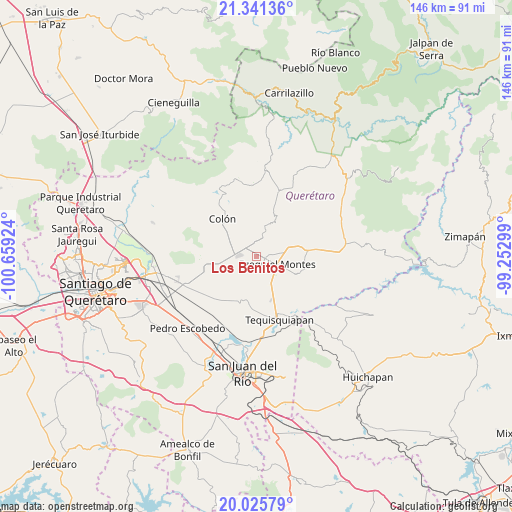
Los Benitos GPS coordinates[2]
20° 41' 6" North, 99° 57' 21.996" West
| Map corner | latitude | longitude |
|---|---|---|
| Upper-left | 21.34136°, | -100.65924° |
| Center: | 20.685°, | -99.95611° |
| Lower-right: | 20.02579°, | -99.25299° |
| Map W x H: | 146.3×146.3 km | = 90.9×90.9mi |
| max Lat: | 32.7° ⇑28.6% North |
| Los Benitos: | 20.685° |
| min Lat: | ⇓71.4% South 14.53588° |
| min Long | Los Benitos | max Long |
| -117.105° | -99.95611° | -86.73105° |
| W 36.6%⇐ | ⇒63.4% E |
Elevation
Elevation of Los Benitos is 1966 m = 6450 ft, and this is 712.3 m = 2337 ft above average elevation for this country.
| Max E: |
3497 m = 11473 ft | 28% |
| Los Benitos | 1966 m 6450 ft | |
| Avg. | 1253.7 m = 4113 ft | |
Min E: |
-1 m = -3 ft | 72% |
See also: Mexico elevation on elevation.city.
Geographical zone
Los Benitos is located in North Torrid zone (between Equator and Tropic of Cancer). Distance of this Northern Tropic circle is 306 km =190.1 mi to North.| Distance of | km | miles | from Los Benitos |
|---|---|---|---|
| North Pole | 7707.1 | 4789 | to North |
| Arctic Circle | 5101.2 | 3169.7 | to North |
| Tropic Cancer | 306 | 190.1 | to North |
| Equator | 2300 | 1429.2 | to South |


Nearby cities:
15 places around Los Benitos: (largest is in red/bold)
• Ajuchitlán
7.1 km =4.4 mi,  290°
290°
• Alfredo V. Bonfil (Los Pérez)
8.2 km =5.1 mi,  83°
83°
• Bernal
6.3 km =3.9 mi,  14°
14°
• El Jagüey Grande
6.7 km =4.2 mi,  42°
42°
• Ezequiel Montes
6.3 km =3.9 mi,  110°
110°
• La Providencia (Las Norbertas)
7.8 km =4.8 mi, 112°
• La Purísima
4.6 km =2.9 mi,  104°
104°
• San Antonio de la Cal
9.3 km =5.8 mi, 11°
• San José de la Laja
7.7 km =4.8 mi,  195°
195°
• San José del Jagüey
6.7 km =4.2 mi,  29°
29°
• San Martín
4.7 km =2.9 mi,  334°
334°
• Santa Rosa Finca
2.1 km =1.3 mi,  210°
210°
• Santa Rosa de Lima
3.2 km =2 mi,  227°
227°
• Santillán
9.5 km =5.9 mi,  169°
169°
• Tunas Blancas
8.9 km =5.5 mi,  70°
70°
Sources, notices
• [Note1] Compared only with cities in Mexico existing in our database
• [Src1] Map data: © OpenStreetMap contributors (CC-BY-SA)
• [Src2] Other city data from geonames.org with taken over terms of usage.
• [Src3] Geographical zone / Annual Mean Temperature by Robert A. Rohde @ Wikipedia
